Mount St Helens
Numéro d’image : 11740737
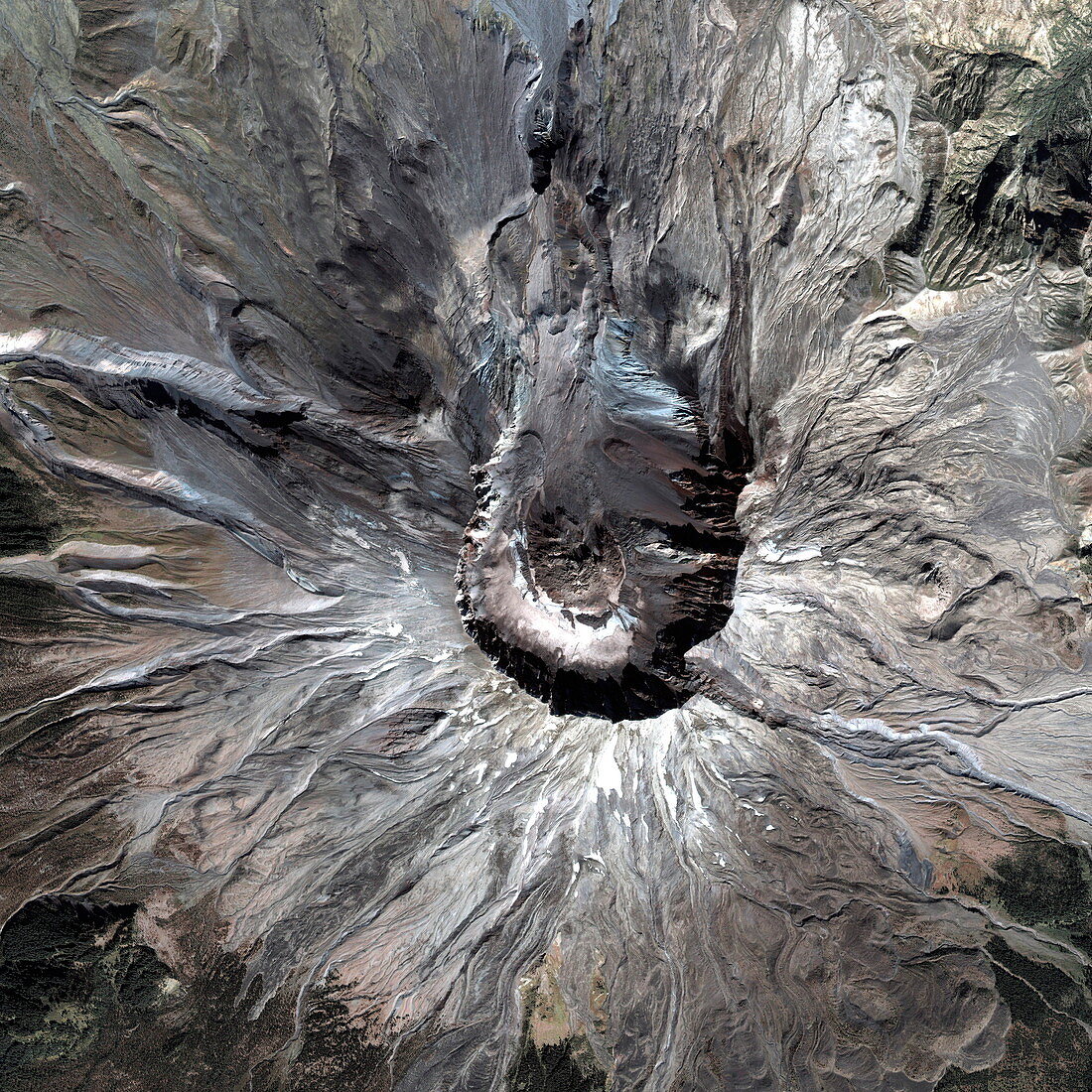
| Mount St Helens. Satellite image of the summit of the Mount St Helens volcano,in Washington State,USA. The summit crater (centre,2 kilometres wide and 640 metres deep) was formed during a massive volcanic eruption on 18 May 1980,following months of volcanic activity. The bulging northern face of the volcano collapsed and a massive pyroclastic flow erupted northwards (towards top),leaving a massive gap in the crater that formed. The volcano was reduced in height by 400 metres,hundreds of square kilometres of forest were destroyed and 57 people died. A post-eruption lava dome (centre) formed in the crater. Image taken by the Ikonos satellite on 13 September 2003 | |
| Licence : | Droits gérés |
| Crédit: | Science Photo Library / Geoeye |
| Taille de l’image : | 3000 px × 3000 px |
| Model Release : | Non requis |
| Property Release : | Non requis |
| Restrictions : | - |
Prix pour cette image À partir de 45 €
Produit vendu
(Calendrier, Carte postale, Carte de vœux, Impression sur textile, Packaging etc)
À partir de 45 €
Usage commercial
(Affichage, Annonce presse, Annonce TV, Carte, Digital - hors rés. sociaux, Digital - rés. sociaux etc)
À partir de 45 €
Éditorial
(Digital, Journal, Livre, Livre pratique, Magazine, Télévision etc)
À partir de 60 €
Usage non-commercial
(Digital - hors rés. sociaux, Digital - rés. sociaux etc)
À partir de 120 €
Mots clés
- 21ème siècle,
- actif,
- américain,
- Amérique du Nord,
- caldera,
- cratère,
- cratère volcanique,
- crête,
- de l'espace,
- Etats-Unis,
- géographie,
- géographique,
- géologie,
- géologique,
- Ikonos,
- image satellite,
- mont Saint Hélène,
- mont Saint Helens,
- mont St Hélène,
- mont St Helens,
- montagne,
- N/A,
- nature,
- observation de la terre,
- pic,
- pointe,
- roche,
- rocheux,
- saint,
- satellite,
- sommet,
- US,
- USA,
- volcan,
- volcanique,
- vulcanologie,
- Washington,
- XX1ème siècle