Mount Kilimanjaro,satellite image
Numéro d’image : 11740720
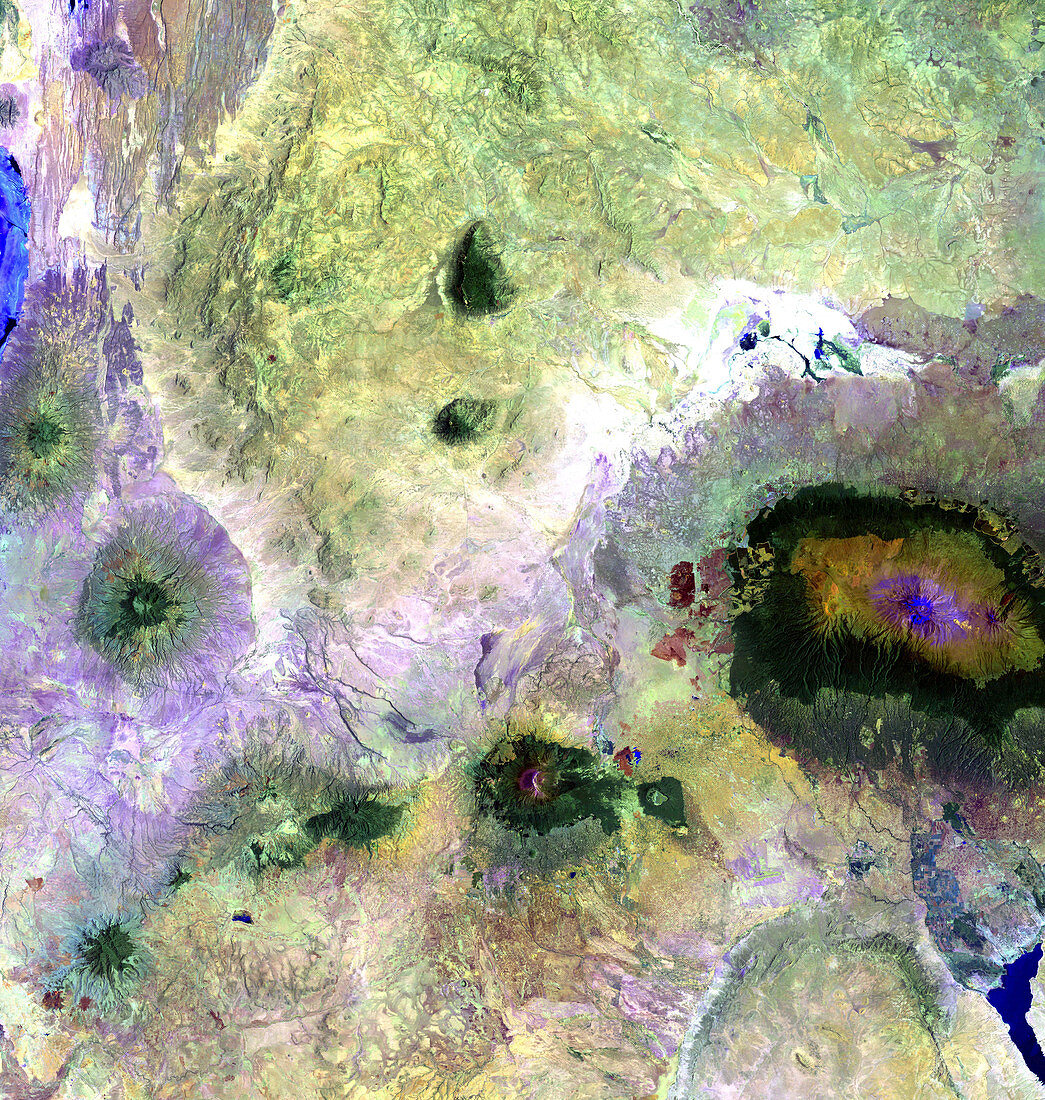
| Mount Kilimanjaro,Tanzania,satellite image. The peak of Kilimanjaro is on the right. To the north lie the plains of the Amboseli National Park. To the south and west is the Arusha National Park. Mount Kilimanjaro stands 5895 metres tall,making it the highest mountain in Africa. It last erupted 100,000 years ago,but still shows signs of residual volcanic activity. Image taken by the Enhanced Thematic Mapper Plus (ETM+) on the Landsat 7 satellite,on February 21st 2000 | |
| Licence : | Droits gérés |
| Crédit: | Science Photo Library / NASA |
| Taille de l’image : | 4000 px × 4212 px |
| Model Release : | Non requis |
| Property Release : | Non requis |
| Restrictions : | - |
Prix pour cette image À partir de 45 €
Produit vendu
(Calendrier, Carte postale, Carte de vœux, Impression sur textile, Packaging etc)
À partir de 45 €
Usage commercial
(Affichage, Annonce presse, Annonce TV, Carte, Digital - hors rés. sociaux, Digital - rés. sociaux etc)
À partir de 45 €
Éditorial
(Digital, Journal, Livre, Livre pratique, Magazine, Télévision etc)
À partir de 60 €
Usage non-commercial
(Digital - hors rés. sociaux, Digital - rés. sociaux etc)
À partir de 120 €
Mots clés
- 2000,
- africain,
- Afrique,
- appareil de cartographie thématique amélioré,
- Arusha,
- Enhanced Thematic Mapper Plus,
- ETM+,
- géologie,
- géologique,
- image satellite,
- imagerie,
- Kilimanjaro,
- Landsat,
- mont,
- montage,
- montagne,
- monter,
- observation de la terre,
- parc national d'Amboseli,
- Tanzanie,
- tanzanien,
- volcan,
- volcanique