Great Rift Valley lakes,Ethiopia
Numéro d’image : 11740392
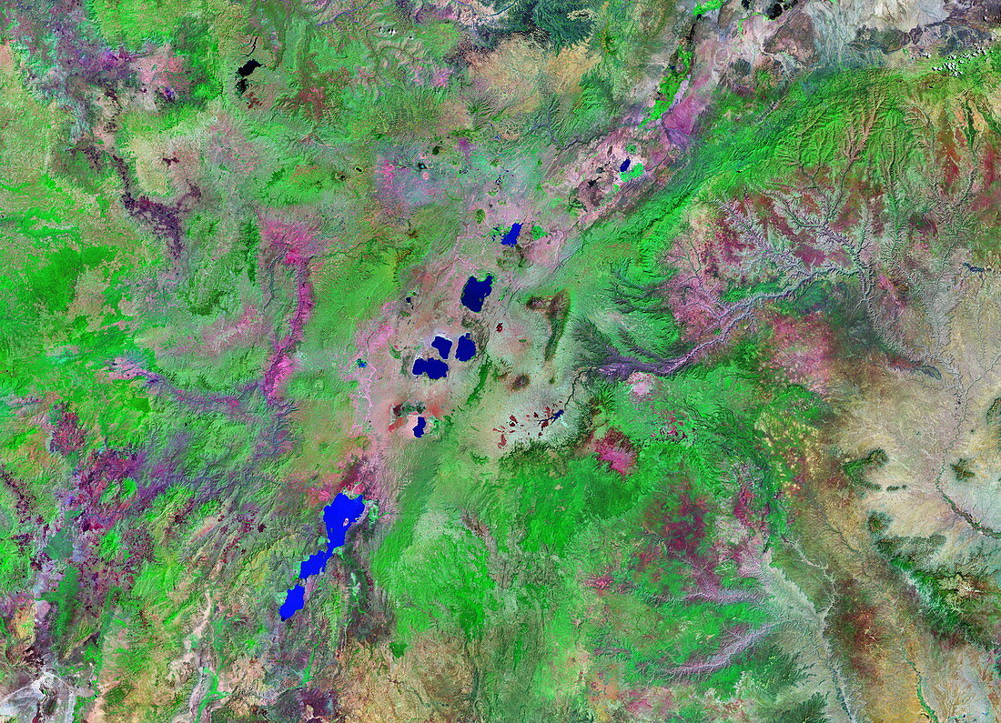
| Great Rift Valley lakes,Ethiopia,satellite image in infrared and visible light. The colours shown are assigned to different parts of the visible and infrared spectrum,revealing vegetation (green),water (blue) and bare ground (red/grey). The area shown is about 700 kilometres wide. These lakes are in southern Ethiopia,in the northern part of the Great Rift Valley. The lakes vary from shallow to deep,some being volcanic craters,and from a milky blue to red colour,depending on the origin of the lake and its surroundings. The larger lakes to the south support large amounts of wildlife. This image is a GeoCover mosaic using data from the Landsat 7 satellite's ETM+ sensor in 2000 | |
| Licence : | Droits gérés |
| Crédit: | Science Photo Library / NASA |
| Taille de l’image : | 5120 px × 3700 px |
| Model Release : | Non requis |
| Property Release : | Non requis |
| Restrictions : | - |
Prix pour cette image À partir de 45 €
Produit vendu
(Calendrier, Carte postale, Carte de vœux, Impression sur textile, Packaging etc)
À partir de 45 €
Usage commercial
(Affichage, Annonce presse, Annonce TV, Carte, Digital - hors rés. sociaux, Digital - rés. sociaux etc)
À partir de 45 €
Éditorial
(Digital, Journal, Livre, Livre pratique, Magazine, Télévision etc)
À partir de 60 €
Usage non-commercial
(Digital - hors rés. sociaux, Digital - rés. sociaux etc)
À partir de 120 €
Mots clés
- 2000,
- 21ème siècle,
- africain,
- Afrique,
- appareil de cartographie thématique amélioré,
- de l'espace,
- Enhanced Thematic Mapper Plus,
- Ethiopie,
- éthiopien,
- ETM+,
- géographie,
- géographique,
- géologie,
- géologique,
- image satellite,
- infrarouge,
- IR,
- lac,
- lacs,
- Landsat,
- landsat 7,
- nature,
- observation de la terre,
- satellite,
- vallée du grand rift,
- vallée du Rift,
- volcanique,
- XX1ème siècle