2005 Kashmir earthquake intensity map
Numéro d’image : 11740328
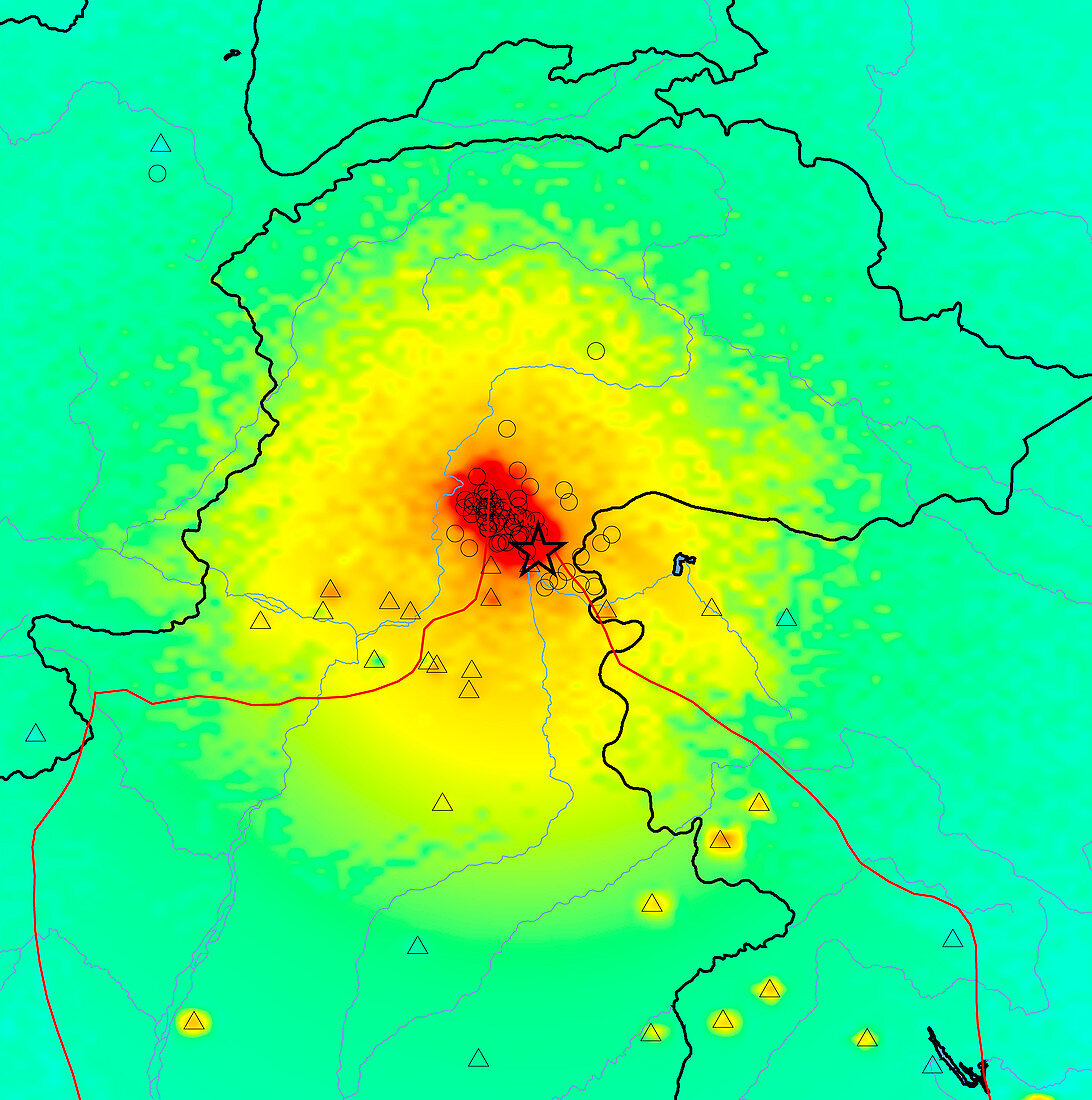
| 2005 Kashmir earthquake intensity map. This earthquake,which struck the Pakistani region of Kashmir,occurred at 3:50am GMT on 8th October 2005. It had a magnitude of 7.6,and led to the deaths of nearly 100,000 people. The epicentre is marked by the black star. The intensity of the shaking is colour coded,from red (extreme) through orange (severe) and yellow (strong) to green (moderate). The region lies where the Indian tectonic plate (below red line) collides with the Eurasian tectonic plate (above red line). This collision,which began some 50 million years ago,formed the Himalaya mountain range | |
| Licence : | Droits gérés |
| Crédit: | Science Photo Library / US Geological Survey |
| Taille de l’image : | 3877 px × 3905 px |
| Model Release : | Non requis |
| Property Release : | Non requis |
| Restrictions : | - |
Prix pour cette image À partir de 45 €
Produit vendu
(Calendrier, Carte postale, Carte de vœux, Impression sur textile, Packaging etc)
À partir de 45 €
Usage commercial
(Affichage, Annonce presse, Annonce TV, Carte, Digital - hors rés. sociaux, Digital - rés. sociaux etc)
À partir de 45 €
Éditorial
(Digital, Journal, Livre, Livre pratique, Magazine, Télévision etc)
À partir de 60 €
Usage non-commercial
(Digital - hors rés. sociaux, Digital - rés. sociaux etc)
À partir de 120 €
Mots clés
- 2005,
- 21ème siècle,
- asiatique,
- Asie,
- Asie du Sud,
- Cachemire,
- carte d'intensité,
- carte intensité,
- catastrophe naturelle,
- géographie,
- géographique,
- géologie,
- géologique,
- illustration,
- illustration informatique,
- illustration par ordinateur,
- intensité,
- observation de la terre,
- oeuvre,
- Pakistan,
- science de la terre,
- secouer,
- secousse,
- sismologie,
- sismologique,
- tremblement de terre,
- XX1ème siècle