Hurricane Emily,16 July 2005
Numéro d’image : 11738040
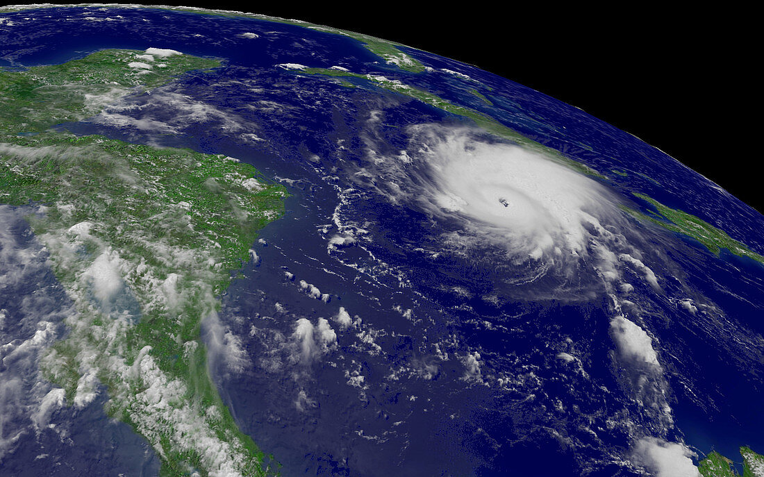
| Hurricane Emily. Satellite image of Hurricane Emily (centre) passing south of the island of Jamaica in the Caribbean Sea on 16 July 2005 at 1845 GMT. Emily is the second hurricane in a week to pass by Jamaica,causing flooding and deaths. Cuba is just above the hurricane. Mexico,Honduras and Nicaragua are on the left. Hurricanes are enormous rotating storm systems in which winds can reach over 240 kph. At the time this image was taken,Emily was classified as a borderline category 4/5 hurricane,producing winds of 249 kilometres per hour. Image taken by the GOES 12 satellite | |
| Licence : | Droits gérés |
| Crédit: | Science Photo Library / NOAA |
| Taille de l’image : | 1919 px × 1199 px |
| Model Release : | Non requis |
| Property Release : | Non requis |
| Restrictions : |
|
Prix pour cette image À partir de 45 €
Produit vendu
(Calendrier, Carte postale, Carte de vœux, Impression sur textile, Packaging etc)
À partir de 45 €
Usage commercial
(Affichage, Annonce presse, Annonce TV, Carte, Digital - hors rés. sociaux, Digital - rés. sociaux etc)
À partir de 45 €
Éditorial
(Digital, Journal, Livre, Livre pratique, Magazine, Télévision etc)
À partir de 60 €
Usage non-commercial
(Digital - hors rés. sociaux, Digital - rés. sociaux etc)
À partir de 120 €