Atmospheric carbon monoxide
Numéro d’image : 11736378
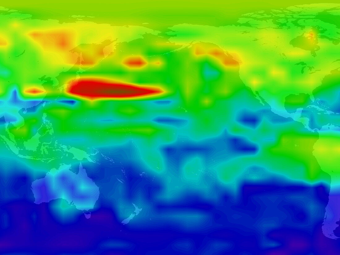
| Atmospheric carbon monoxide. Image 2 of 4. Satellite image of atmospheric carbon monoxide (CO) flowing east across the Pacific Ocean at an altitude of 4500 metres. Red indicates areas of high concentration (approximately 250 parts per billion) and blue indicates areas of low concentration (approximately 40 parts per billion). CO is caused by the incomplete combustion of carbon in,for instance,forest fires and petrol engines. It is an important tropospheric (lowest region of the atmosphere) pollutant. Image taken by NASA's TERRA satellite on March 12 2000. Images E100/221 to E100/224 show the carbon monoxide's progression over six days | |
| Licence : | Droits gérés |
| Crédit: | Science Photo Library / NASA |
| Taille de l’image : | 2560 px × 1920 px |
| Model Release : | Non requis |
| Property Release : | Non requis |
| Restrictions : | - |
Prix pour cette image À partir de 45 €
Produit vendu
(Calendrier, Carte postale, Carte de vœux, Impression sur textile, Packaging etc)
À partir de 45 €
Usage commercial
(Affichage, Annonce presse, Annonce TV, Carte, Digital - hors rés. sociaux, Digital - rés. sociaux etc)
À partir de 45 €
Éditorial
(Digital, Journal, Livre, Livre pratique, Magazine, Télévision etc)
À partir de 60 €
Usage non-commercial
(Digital - hors rés. sociaux, Digital - rés. sociaux etc)
À partir de 120 €