North West England
Numéro d’image : 11736245
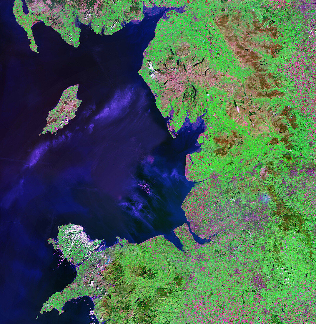
| North West England. Satellite image of part of North West England. North is at top. Urban areas are purple,vegetation is green and water is blue. The island at left,in the Irish Sea,is the Isle of Man. To its right on the mainland is the Lake District (pink). To the right of that is part of the Pennines mountain range (brown). The bay directly below the Lake District is Morecombe Bay. The urban area at the centre of the bay is Lancaster. On the coast directly below Lancaster is Blackpool,below this is Liverpool,which surrounds the estuary of the river Mersey. Part of North Wales is at bottom left. Image taken by NASA's Landsat 7 satellite | |
| Licence : | Droits gérés |
| Crédit: | Science Photo Library / NASA |
| Taille de l’image : | 4084 px × 4182 px |
| Model Release : | Non requis |
| Property Release : | Non requis |
| Restrictions : | - |
Prix pour cette image À partir de 45 €
Produit vendu
(Calendrier, Carte postale, Carte de vœux, Impression sur textile, Packaging etc)
À partir de 45 €
Usage commercial
(Affichage, Annonce presse, Annonce TV, Carte, Digital - hors rés. sociaux, Digital - rés. sociaux etc)
À partir de 45 €
Éditorial
(Digital, Journal, Livre, Livre pratique, Magazine, Télévision etc)
À partir de 60 €
Usage non-commercial
(Digital - hors rés. sociaux, Digital - rés. sociaux etc)
À partir de 120 €
Mots clés
- Anglesey,
- Angleterre,
- baie,
- Blackpool,
- britannique,
- chaîne de montagnes,
- chaîne montagneuse,
- cordillère,
- de l'espace,
- Europe,
- européen,
- géographie,
- géographique,
- grand,
- Grande-Bretagne,
- île,
- île de Man,
- îles,
- Iles Britanniques,
- image satellite,
- Lancashire,
- Lancaster,
- Liverpool,
- mer,
- montagne,
- observation de la terre,
- région des lacs,
- Royaume Uni,
- Royaume-Uni,
- satellite,
- science de la terre,
- sciences,
- terre,
- urbain,
- végétation,
- ville,
- villes