Land use around Medway Estuary,Kent
Numéro d’image : 11736187
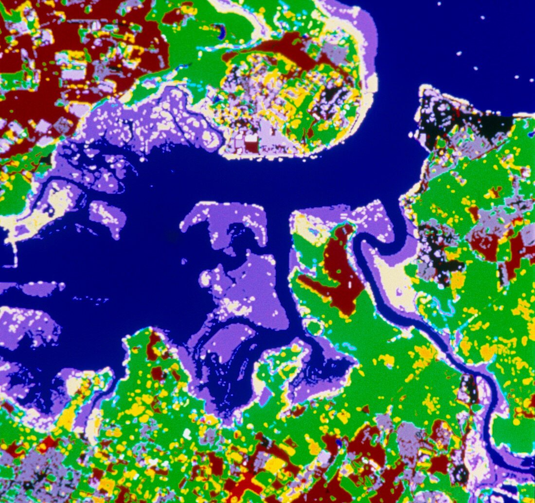
| Estuary land use. Coloured map of land use around the Medway Estuary,Kent,derived from satellite data. The dark blue represents the River Medway,with mid-blue areas showing salt marsh and intertidal land. Most of the surrounding countryside is either pasture (green) or arable land (brown). Pale yellow areas are beaches or mudflats. Built-up areas are shown in grey (low density) or black (high density). The black area at top right is Sheerness; on the opposite bank of the estuary is a large grey area of the petro- chemical works on the Isle of Grain. The grey area at bottom left is the town of Gillingham | |
| Licence : | Droits gérés |
| Crédit: | Science Photo Library / INSTITUTE OF TERRESTRIAL ECOLOGY |
| Taille de l’image : | 4734 px × 4456 px |
| Model Release : | Non requis |
| Property Release : | Non requis |
| Restrictions : | - |
Prix pour cette image À partir de 45 €
Produit vendu
(Calendrier, Carte postale, Carte de vœux, Impression sur textile, Packaging etc)
À partir de 45 €
Usage commercial
(Affichage, Annonce presse, Annonce TV, Carte, Digital - hors rés. sociaux, Digital - rés. sociaux etc)
À partir de 45 €
Éditorial
(Digital, Journal, Livre, Livre pratique, Magazine, Télévision etc)
À partir de 60 €
Usage non-commercial
(Digital - hors rés. sociaux, Digital - rés. sociaux etc)
À partir de 120 €