France
Numéro d’image : 11736083
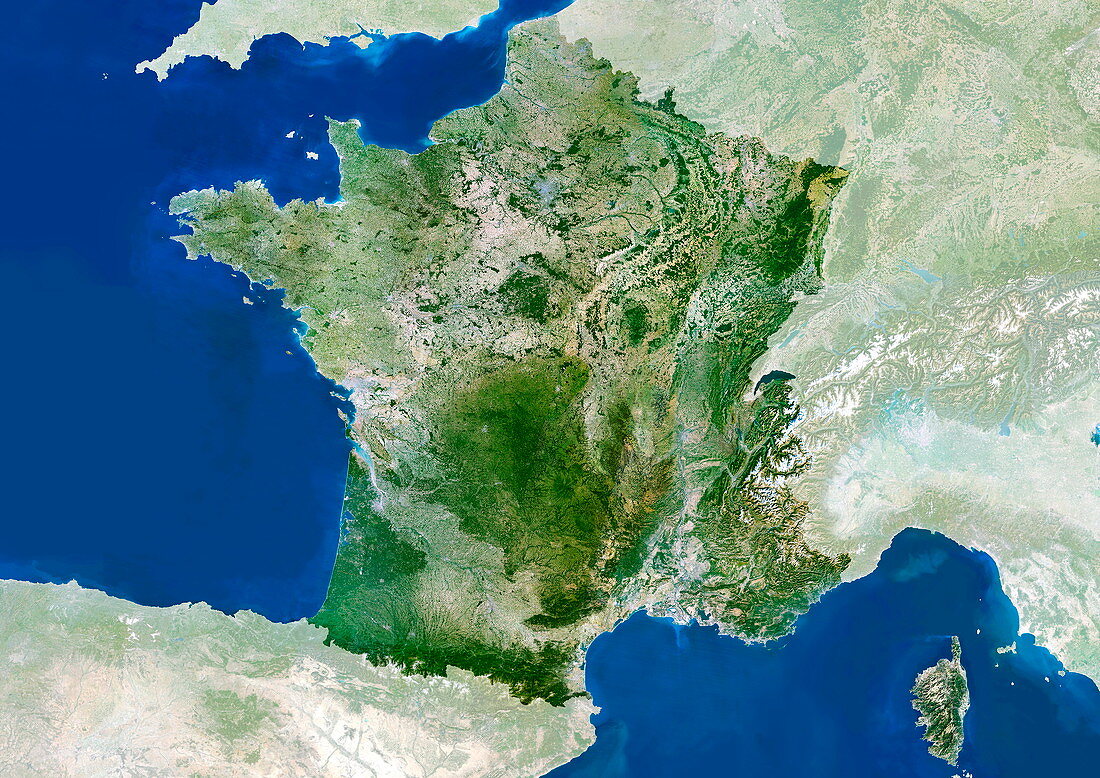
| France. Satellite image of the European country of France. The surrounding area has been shaded out. North is at top. Water is blue,vegetation is green,urban areas are grey,dry areas are brown,snow and ice are white,and shallow coastal waters are light blue. The area here is about 550 by 400 kilometres. The capital city of France,Paris,is at upper centre. The island of Corsica (at lower right in the Mediterranean Sea) is part of France. France's other coastline is on the Bay of Biscay and the Atlantic Ocean. The terrain in France varies from fields and forests to mountains (the Alps are at lower right and the Pyrenees form the southern border with Spain). For an unshaded map of this area,see E075/082 | |
| Licence : | Droits gérés |
| Crédit: | Science Photo Library / Planetobserver |
| Taille de l’image : | 4961 px × 3508 px |
| Model Release : | Non requis |
| Property Release : | Non requis |
| Restrictions : | - |
Prix pour cette image À partir de 45 €
Produit vendu
(Calendrier, Carte postale, Carte de vœux, Impression sur textile, Packaging etc)
À partir de 45 €
Usage commercial
(Affichage, Annonce presse, Annonce TV, Carte, Digital - hors rés. sociaux, Digital - rés. sociaux etc)
À partir de 45 €
Éditorial
(Digital, Journal, Livre, Livre pratique, Magazine, Télévision etc)
À partir de 60 €
Usage non-commercial
(Digital - hors rés. sociaux, Digital - rés. sociaux etc)
À partir de 120 €
Mots clés
- Alpes,
- Atlantique,
- CORSICA,
- côte,
- de l'espace,
- eau,
- état,
- Europe,
- européen,
- français,
- France,
- frontière,
- frontières,
- géographie,
- géographique,
- golfe de Gascogne,
- île,
- image satellite,
- littoral,
- Manche,
- méditérranéen,
- mer,
- montagnes,
- nation,
- observation de la terre,
- océan,
- Paris,
- pays,
- pyrénées,
- satellite,
- terre