France
Numéro d’image : 11736082
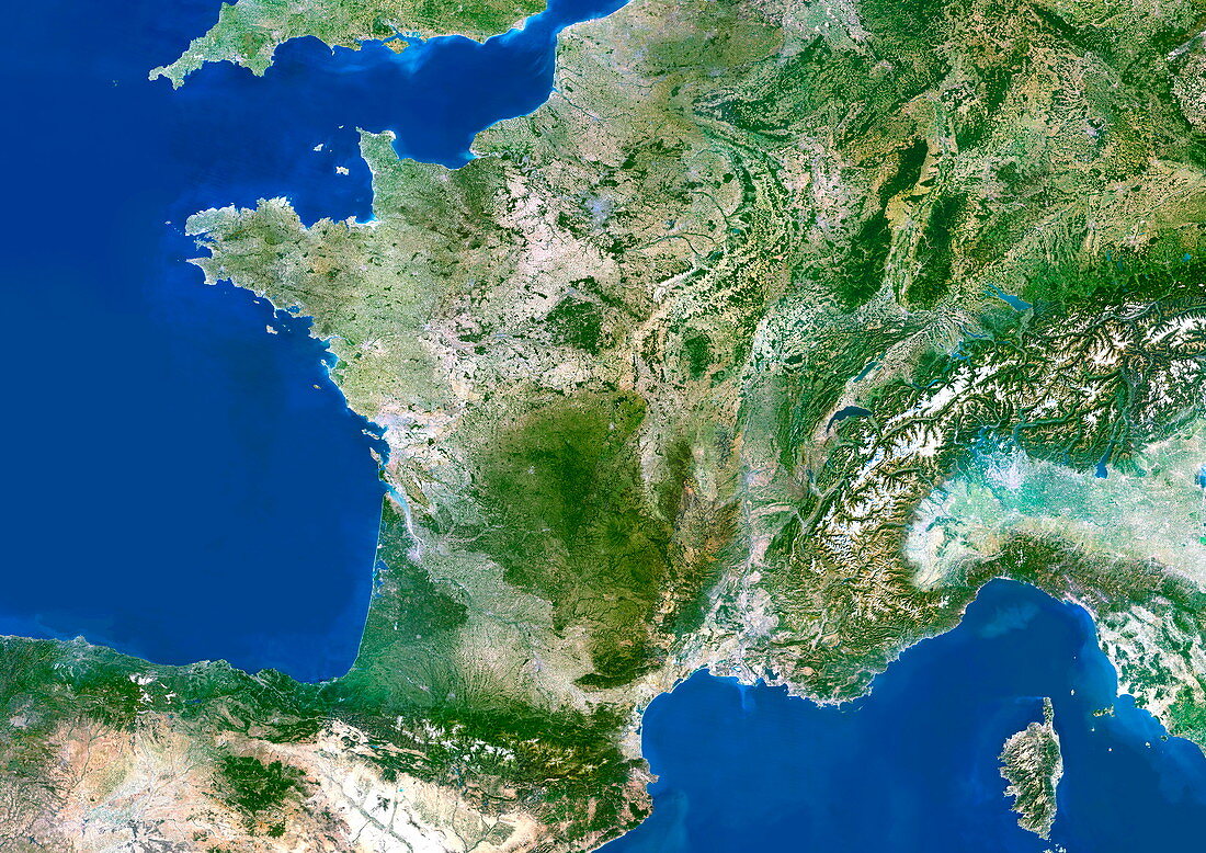
| France. Satellite image of the European country of France and the surrounding area. North is at top. Water is blue,vegetation is green,urban areas are grey,dry areas are brown,snow and ice are white,and shallow coastal waters are light blue. The area here is about 550 by 400 kilometres. The major geographical features are the capital city of France,Paris (upper centre),part of Belgium and Germany (upper right),the Alps mountain range (centre right,including Switzerland and parts of Austria and Italy),Corsica in the Mediterranean Sea (bottom right),northern Spain (lower left),the Bay of Biscay (centre left) and the English Channel and part of England (upper left). For the borders of France,see E075/086 | |
| Licence : | Droits gérés |
| Crédit: | Science Photo Library / Planetobserver |
| Taille de l’image : | 4961 px × 3508 px |
| Model Release : | Non requis |
| Property Release : | Non requis |
| Restrictions : | - |
Prix pour cette image À partir de 45 €
Produit vendu
(Calendrier, Carte postale, Carte de vœux, Impression sur textile, Packaging etc)
À partir de 45 €
Usage commercial
(Affichage, Annonce presse, Annonce TV, Carte, Digital - hors rés. sociaux, Digital - rés. sociaux etc)
À partir de 45 €
Éditorial
(Digital, Journal, Livre, Livre pratique, Magazine, Télévision etc)
À partir de 60 €
Usage non-commercial
(Digital - hors rés. sociaux, Digital - rés. sociaux etc)
À partir de 120 €