Production of a satellite image
Numéro d’image : 11736078
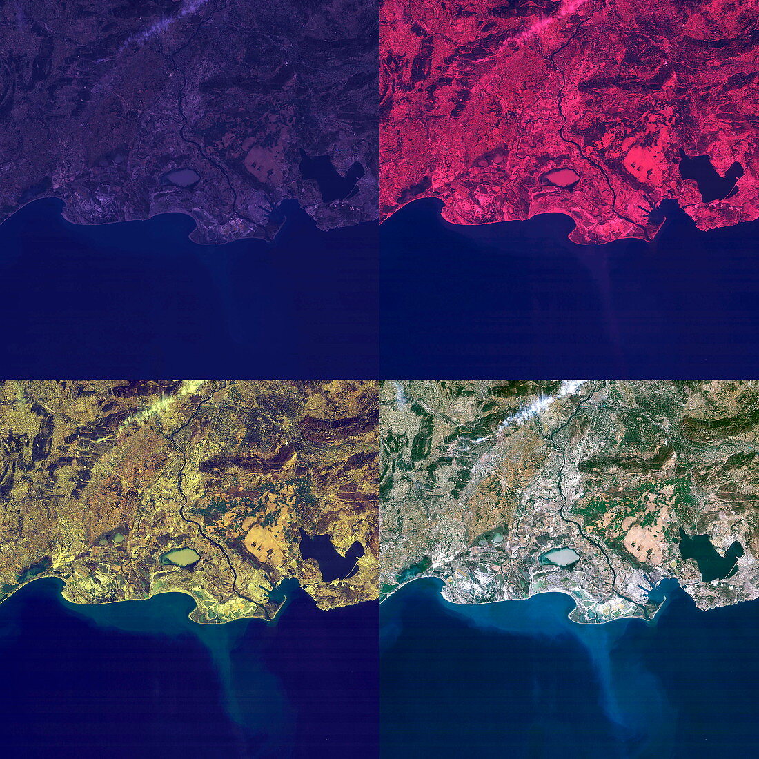
| Production of a satellite image. Four images of the Camargue region,France,are used to demonstrate the method by which a satellite produces a natural colour image. The satellite records light in the wavelengths of each of the primary colours: red (top right),blue (top left) and green (bottom left). These are then combined to produce the image in the bottom right. The Camargue is the delta of the River Rhone. It contains large brine lagoons and is important for birdlife | |
| Licence : | Droits gérés |
| Crédit: | Science Photo Library / Planetobserver |
| Taille de l’image : | 3543 px × 3543 px |
| Model Release : | Non requis |
| Property Release : | Non requis |
| Restrictions : | - |
Prix pour cette image À partir de 45 €
Produit vendu
(Calendrier, Carte postale, Carte de vœux, Impression sur textile, Packaging etc)
À partir de 45 €
Usage commercial
(Affichage, Annonce presse, Annonce TV, Carte, Digital - hors rés. sociaux, Digital - rés. sociaux etc)
À partir de 45 €
Éditorial
(Digital, Journal, Livre, Livre pratique, Magazine, Télévision etc)
À partir de 60 €
Usage non-commercial
(Digital - hors rés. sociaux, Digital - rés. sociaux etc)
À partir de 120 €