Western Sahara Berm,satellite image
Numéro d’image : 11735955
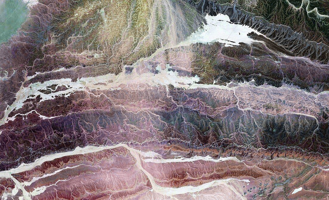
| Western Sahara Berm. Landsat satellite image showing the Western Sahara Berm,or Moroccan wall (white). North is at top. The Berm actually consists of six walls,which were built between 1981 and 1987. They were built by the Moroccan government to separate the Moroccan-controlled area of Western Sahara from territory (to the east) held by the Polisario Front,who want independence for Western Sahara | |
| Licence : | Droits gérés |
| Crédit: | Science Photo Library / NASA |
| Taille de l’image : | 6247 px × 3805 px |
| Model Release : | Non requis |
| Property Release : | Non requis |
| Restrictions : | - |
Prix pour cette image À partir de 45 €
Produit vendu
(Calendrier, Carte postale, Carte de vœux, Impression sur textile, Packaging etc)
À partir de 45 €
Usage commercial
(Affichage, Annonce presse, Annonce TV, Carte, Digital - hors rés. sociaux, Digital - rés. sociaux etc)
À partir de 45 €
Éditorial
(Digital, Journal, Livre, Livre pratique, Magazine, Télévision etc)
À partir de 60 €
Usage non-commercial
(Digital - hors rés. sociaux, Digital - rés. sociaux etc)
À partir de 120 €
Mots clés
- 1900,
- 1980,
- 20ème siècle,
- africain,
- Afrique,
- artificiel,
- barrière,
- conflit,
- contenir,
- contesté,
- côte,
- d'origine humaine,
- de l'espace,
- dispute,
- frontière,
- géographie,
- géographique,
- histoire,
- historique,
- image satellite,
- images,
- Landsat,
- limite,
- Maroc,
- mur,
- murs,
- observation de la terre,
- obstacle,
- Océan Atlantique,
- pays,
- photo,
- photos,
- politique,
- science de la terre,
- sciences,
- séparation,
- séparer,
- XXème siècle