Europe,satellite image
Numéro d’image : 11735933
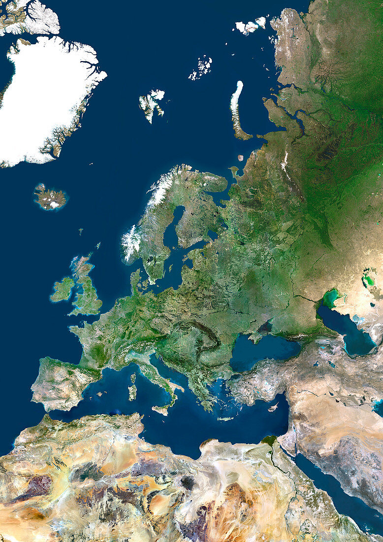
| Europe,satellite image. North is at top. Green area are vegetated. Yellow areas are desert. White areas are ice. The British Isles are in the west. To the northwest of Britain is Iceland and the Greenland ice cap (white). Northeast of Britain across the North Sea is Scandinavia and east of Scandinavia is Asia. Southeast of Britain is mainland Europe. The Mediterranean Sea divides Europe from Africa to the south. North Africa is dominated by the Sahara Desert. The west coast of Europe and the British Isles is bounded by the Atlantic Ocean | |
| Licence : | Droits gérés |
| Crédit: | Science Photo Library / Planetobserver |
| Taille de l’image : | 3508 px × 4961 px |
| Model Release : | Non requis |
| Property Release : | Non requis |
| Restrictions : | - |
Prix pour cette image À partir de 45 €
Produit vendu
(Calendrier, Carte postale, Carte de vœux, Impression sur textile, Packaging etc)
À partir de 45 €
Usage commercial
(Affichage, Annonce presse, Annonce TV, Carte, Digital - hors rés. sociaux, Digital - rés. sociaux etc)
À partir de 45 €
Éditorial
(Digital, Journal, Livre, Livre pratique, Magazine, Télévision etc)
À partir de 60 €
Usage non-commercial
(Digital - hors rés. sociaux, Digital - rés. sociaux etc)
À partir de 120 €
Mots clés
- africain,
- Afrique,
- britannique,
- calotte glaciaire,
- cartographie,
- composite,
- continent,
- de l'espace,
- désert,
- Europe,
- européen,
- géographie,
- géographique,
- glace,
- Grande-Bretagne,
- Groenland,
- hémisphère Nord,
- image satellite,
- images,
- mer,
- Mer du Nord,
- Mer Méditérrannée,
- observation de la terre,
- océan,
- Océan Atlantique,
- photo,
- photos,
- Royaume Uni,
- Royaume-Uni,
- Sahara,
- satellite,
- Scandinavie,
- science de la terre,
- sciences,
- terre,
- topographie