Benelux region
Numéro d’image : 11735903
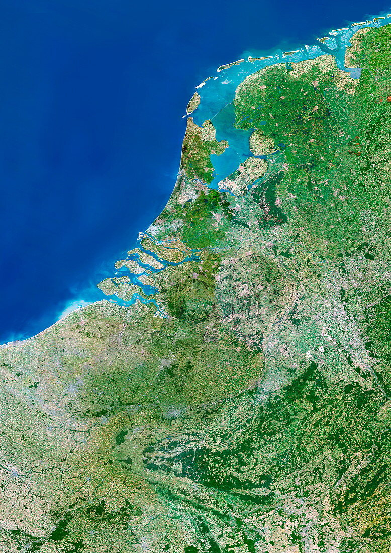
| Benelux region. Satellite image of the Benelux region of Europe. North is at top. Water is blue,vegetation is green,urban areas are grey and the shallow coastal waters are light blue. The area here is about 550 by 400 kilometres. It includes the countries of Belgium,the Netherlands and Luxembourg (collectively called Benelux). Parts of Germany (down right) and France (lower left) are also seen. The Netherlands is at upper right; the barrier islands and dikes protect the low-lying coastline from the North Sea. Belgium is at centre,and Luxembourg is at lower right. This is one of the most densely populated areas of Europe (about 27 million people in 2005) | |
| Licence : | Droits gérés |
| Crédit: | Science Photo Library / Planetobserver |
| Taille de l’image : | 3508 px × 4961 px |
| Model Release : | Non requis |
| Property Release : | Non requis |
| Restrictions : | - |
Prix pour cette image À partir de 45 €
Produit vendu
(Calendrier, Carte postale, Carte de vœux, Impression sur textile, Packaging etc)
À partir de 45 €
Usage commercial
(Affichage, Annonce presse, Annonce TV, Carte, Digital - hors rés. sociaux, Digital - rés. sociaux etc)
À partir de 45 €
Éditorial
(Digital, Journal, Livre, Livre pratique, Magazine, Télévision etc)
À partir de 60 €
Usage non-commercial
(Digital - hors rés. sociaux, Digital - rés. sociaux etc)
À partir de 120 €