Europe
Numéro d’image : 11735898
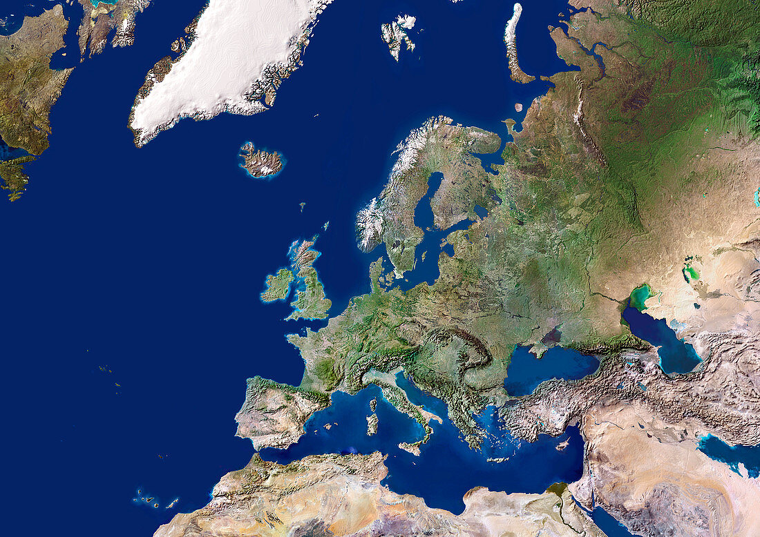
| Europe. Satellite image centred on Europe. North converges towards top. Water is blue,vegetation is green,arid areas are brown,and snow and ice are white. The terrain of Europe varies from arid,dusty areas (brown) to fields,forests and plains (green). Mountain ranges include (left to right): the Pyrenees,the Alps,and the Carpathians. Snow and ice is seen on mountains in Scandinavia and Iceland (upper centre). Seas are the Mediterranean Sea (lower centre),the Black Sea and Caspian Sea (lower right),the Baltic Sea and North Sea (upper centre) and the Atlantic Ocean (left). Also seen are Greenland and Newfoundland (top left),Russia and the Middle East (right),and North Africa (bottom). For this area at night,see E074/055 | |
| Licence : | Droits gérés |
| Crédit: | Science Photo Library / Planetobserver |
| Taille de l’image : | 4961 px × 3508 px |
| Model Release : | Non requis |
| Property Release : | Non requis |
| Restrictions : | - |
Prix pour cette image À partir de 45 €
Produit vendu
(Calendrier, Carte postale, Carte de vœux, Impression sur textile, Packaging etc)
À partir de 45 €
Usage commercial
(Affichage, Annonce presse, Annonce TV, Carte, Digital - hors rés. sociaux, Digital - rés. sociaux etc)
À partir de 45 €
Éditorial
(Digital, Journal, Livre, Livre pratique, Magazine, Télévision etc)
À partir de 60 €
Usage non-commercial
(Digital - hors rés. sociaux, Digital - rés. sociaux etc)
À partir de 120 €
Mots clés
- Afrique du Nord,
- Alpes,
- Arctique,
- Atlantique,
- carte,
- continent,
- continental,
- de l'espace,
- déserts,
- eau,
- Eurasie,
- eurasien,
- Europe,
- européen,
- forêts,
- géographie,
- géographique,
- Groenland,
- image satellite,
- Islande,
- méditérranéen,
- mer,
- Mer caspienne,
- Mer Noire,
- montagnes,
- Moyen Orient,
- Moyen-Orient,
- observation de la terre,
- océan,
- pyrénées,
- Russie,
- satellite,
- Scandinavie,
- terre