Europe
Numéro d’image : 11735883
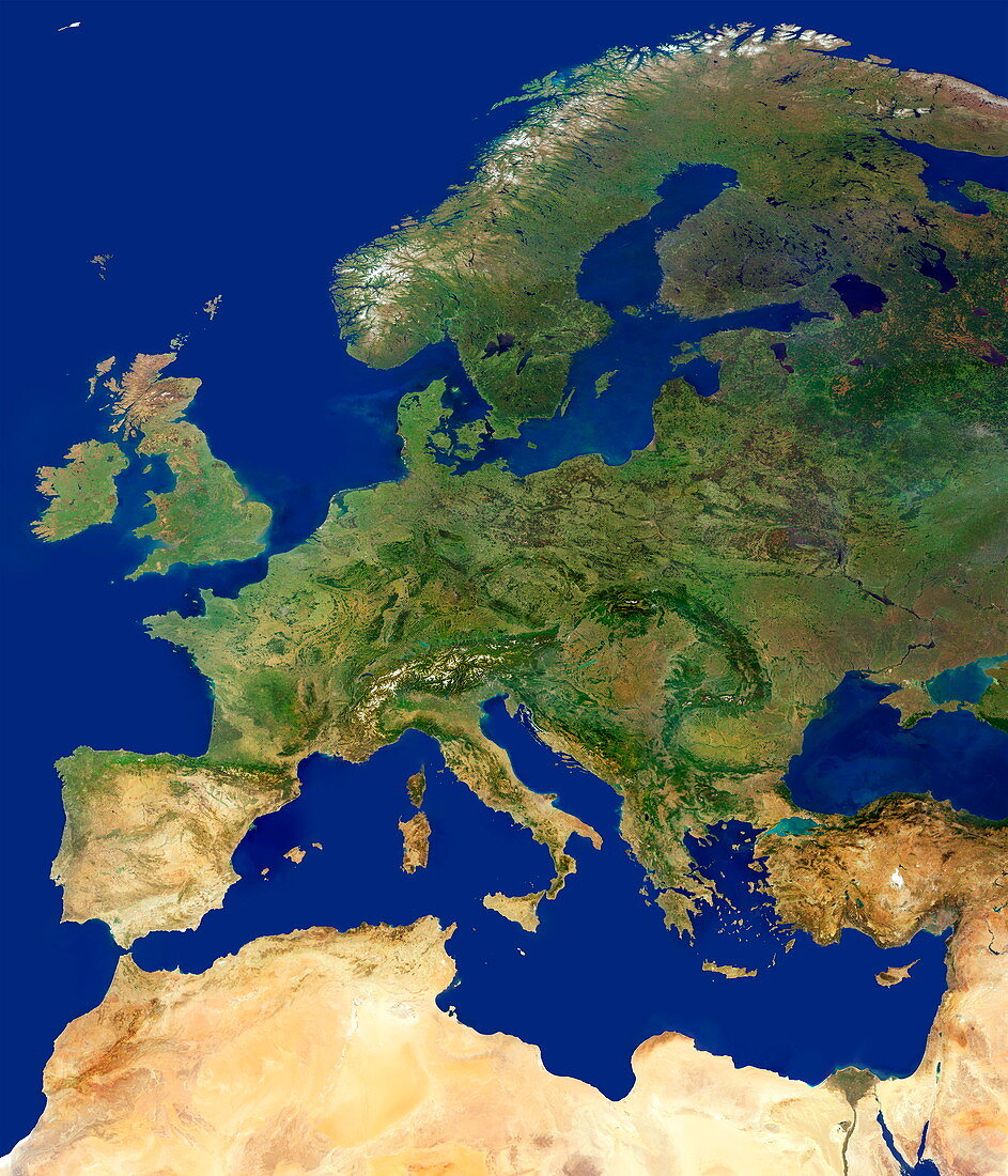
| Europe,cloud-free satellite image. North is at top. Land cover varies from vegetation (green) and snow and salt (white) to arid land (light brown). Sea colour varies from blue to light blue (coastal silt and algal blooms). This view stretches from Europe's Atlantic coasts (left) west to the Black Sea (lower right),and from Scandinavia (upper centre) southwards,past the Baltic Sea and the North Sea,through mainland Europe and across the Mediterranean Sea to the vast deserts of northern Africa (bottom). Major mountain ranges are also seen. This mosaic image uses data from the MODIS sensor on NASA's Terra satellite | |
| Licence : | Droits gérés |
| Crédit: | Science Photo Library / DLR / PLANETARY VISIONS LTD |
| Taille de l’image : | 3000 px × 3500 px |
| Model Release : | Non requis |
| Property Release : | Non requis |
| Restrictions : | - |
Prix pour cette image À partir de 45 €
Produit vendu
(Calendrier, Carte postale, Carte de vœux, Impression sur textile, Packaging etc)
À partir de 45 €
Usage commercial
(Affichage, Annonce presse, Annonce TV, Carte, Digital - hors rés. sociaux, Digital - rés. sociaux etc)
À partir de 45 €
Éditorial
(Digital, Journal, Livre, Livre pratique, Magazine, Télévision etc)
À partir de 60 €
Usage non-commercial
(Digital - hors rés. sociaux, Digital - rés. sociaux etc)
À partir de 120 €
Mots clés
- Afrique du Nord,
- Allemagne,
- baltique,
- britannique,
- continent,
- continental,
- de l'espace,
- désert,
- Espagne,
- Europe,
- européen,
- France,
- géographie,
- géographique,
- Grande-Bretagne,
- Iles Britanniques,
- image satellite,
- Irlande,
- Italie,
- Mainland,
- méditérranéen,
- mer,
- Mer du Nord,
- Mer Noire,
- mers,
- modis,
- observation de la terre,
- océan,
- physique,
- Royaume Uni,
- Royaume-Uni,
- sans nuages,
- satellite,
- Scandinavie,
- terra,
- terre,
- végétation