Southern Africa
Numéro d’image : 11735846
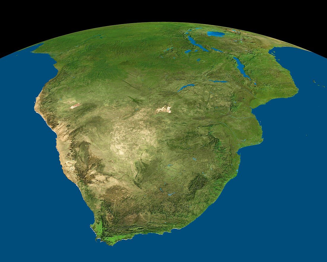
| Southern Africa satellite image. North is at top. Vegetation is green,arid areas are brown and water is blue. Namibia and Mozambique border the South Atlantic and Indian Oceans respectively. South Africa (lower centre) has its capital,Cape Town,situated at the bottom tip of the continent,known as the Cape of Good Hope (lower left). The enclave country of Lesotho (dark green,lower right),Lakes Victoria & Malawi (upper right) and small islands in the Mozambique Channel (far right) are also seen | |
| Licence : | Droits gérés |
| Crédit: | Science Photo Library / Worldsat International |
| Taille de l’image : | 7296 px × 5837 px |
| Model Release : | Non requis |
| Property Release : | Non requis |
| Restrictions : |
|
Prix pour cette image À partir de 45 €
Produit vendu
(Calendrier, Carte postale, Carte de vœux, Impression sur textile, Packaging etc)
À partir de 45 €
Usage commercial
(Affichage, Annonce presse, Annonce TV, Carte, Digital - hors rés. sociaux, Digital - rés. sociaux etc)
À partir de 45 €
Éditorial
(Digital, Journal, Livre, Livre pratique, Magazine, Télévision etc)
À partir de 60 €
Usage non-commercial
(Digital - hors rés. sociaux, Digital - rés. sociaux etc)
À partir de 120 €
Mots clés
- africain,
- Afrique australe,
- Atlantique,
- Botswana,
- Cap de Bonne Espérance,
- de l'espace,
- eau,
- Eswatini,
- état,
- géographie,
- géographique,
- image satellite,
- imagerie satellitaire,
- imagerie satellite,
- images,
- indien,
- mers,
- Mozambique,
- Namibie,
- nation,
- océans,
- pays,
- photo,
- photos,
- science de la terre,
- sciences,
- Sud,
- Swaziland,
- terre,
- topographie,
- topographique,
- végétation