Europe
Numéro d’image : 11735745
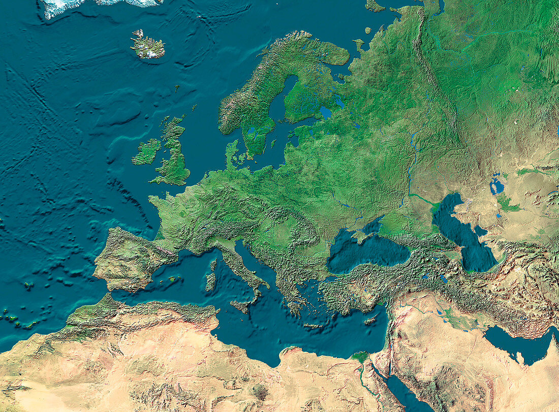
| Europe. True-colour satellite image of Europe and northern Africa. North is at top. Vegetation is green,arid areas are brown and water is blue. Extensive deserts are seen stretching across northern Africa and the Arabian peninsula. The topography of the ocean floors is clearly shown. The Mediterranean Sea (lower centre) separates Europe from Africa. The Black Sea (centre right) is connected to the Mediterranean Sea,while the Caspian Sea (far right) is landlocked,making it the largest inland sea in the world | |
| Licence : | Droits gérés |
| Crédit: | Science Photo Library / Worldsat International |
| Taille de l’image : | 3300 px × 2433 px |
| Model Release : | Non requis |
| Property Release : | Non requis |
| Restrictions : |
|
Prix pour cette image À partir de 45 €
Produit vendu
(Calendrier, Carte postale, Carte de vœux, Impression sur textile, Packaging etc)
À partir de 45 €
Usage commercial
(Affichage, Annonce presse, Annonce TV, Carte, Digital - hors rés. sociaux, Digital - rés. sociaux etc)
À partir de 45 €
Éditorial
(Digital, Journal, Livre, Livre pratique, Magazine, Télévision etc)
À partir de 60 €
Usage non-commercial
(Digital - hors rés. sociaux, Digital - rés. sociaux etc)
À partir de 120 €
Mots clés
- Afrique du nord,
- Atlantique,
- baltique,
- caspien,
- continents,
- de l'espace,
- déserts,
- eau,
- Europe,
- géographie,
- géographique,
- image satellite,
- imagerie satellitaire,
- imagerie satellite,
- images,
- méditérranéen,
- mers,
- noir,
- observation,
- océans,
- photo,
- photos,
- science de la terre,
- sciences,
- terre,
- topographie,
- topographique,
- végétation