Africa and Eurasia
Numéro d’image : 11735744
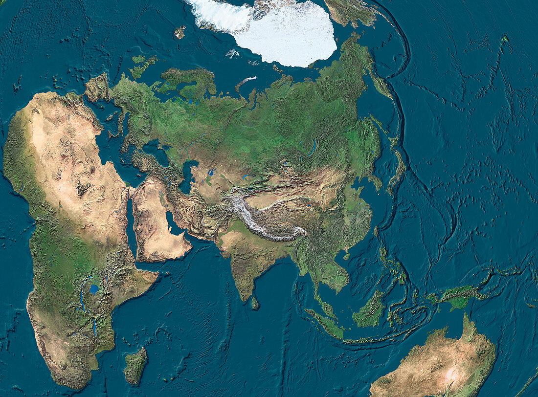
| Africa and Eurasia. True-colour satellite image of Africa,Eurasia and the surrounding regions. North is at top. Vegetation is green,arid areas are brown and water is blue. Extensive deserts are seen stretching across northern Africa,the Arabian peninsula and the interior of Australia (bottom right). Snow and ice (white) cover the Arctic regions around the North Pole,as well as the tops of the Himalayan mountain range (centre). The topography of the ocean floors and underwater mountain ranges is clearly shown | |
| Licence : | Droits gérés |
| Crédit: | Science Photo Library / Worldsat International |
| Taille de l’image : | 4000 px × 2951 px |
| Model Release : | Non requis |
| Property Release : | Non requis |
| Restrictions : |
|
Prix pour cette image À partir de 45 €
Produit vendu
(Calendrier, Carte postale, Carte de vœux, Impression sur textile, Packaging etc)
À partir de 45 €
Usage commercial
(Affichage, Annonce presse, Annonce TV, Carte, Digital - hors rés. sociaux, Digital - rés. sociaux etc)
À partir de 45 €
Éditorial
(Digital, Journal, Livre, Livre pratique, Magazine, Télévision etc)
À partir de 60 €
Usage non-commercial
(Digital - hors rés. sociaux, Digital - rés. sociaux etc)
À partir de 120 €
Mots clés
- Afrique,
- Arctique,
- Asie,
- Asie australe,
- continents,
- de l'espace,
- déserts,
- eau,
- Eurasie,
- Europe,
- géographie,
- géographique,
- glace,
- image satellite,
- imagerie satellitaire,
- imagerie satellite,
- images,
- indien,
- mers,
- neige,
- observation,
- oceania,
- Océanie,
- océans,
- pacifique,
- photo,
- photos,
- Pôle Nord,
- science de la terre,
- sciences,
- terre,
- topographie,
- topographique,
- végétation