Africa and Europe
Numéro d’image : 11735743
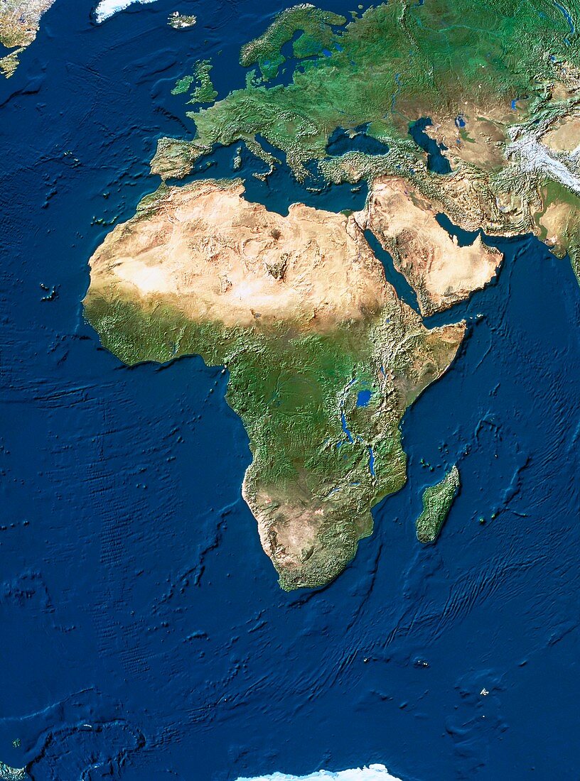
| Africa and Europe. True-colour satellite image of Africa and Europe. North is at top. Vegetation is green,arid areas are brown and water is blue. Extensive deserts are seen stretching across northern Africa and the Arabian peninsula. The topography of the ocean floors is clearly shown. The mid-Atlantic ridge (left) is seen as a series of parallel horizontal lines running down the floor of the Atlantic Ocean. Similar features are seen in the Indian Ocean (right),both caused by tectonic activity in the Earth's crust | |
| Licence : | Droits gérés |
| Crédit: | Science Photo Library / Worldsat International |
| Taille de l’image : | 3601 px × 4856 px |
| Model Release : | Non requis |
| Property Release : | Non requis |
| Restrictions : |
|
Prix pour cette image À partir de 45 €
Produit vendu
(Calendrier, Carte postale, Carte de vœux, Impression sur textile, Packaging etc)
À partir de 45 €
Usage commercial
(Affichage, Annonce presse, Annonce TV, Carte, Digital - hors rés. sociaux, Digital - rés. sociaux etc)
À partir de 45 €
Éditorial
(Digital, Journal, Livre, Livre pratique, Magazine, Télévision etc)
À partir de 60 €
Usage non-commercial
(Digital - hors rés. sociaux, Digital - rés. sociaux etc)
À partir de 120 €
Mots clés
- Afrique,
- Asie de l'ouest,
- asie du Sud-Ouest,
- Asie occidentale,
- Atlantique,
- brèche,
- continents,
- crevasse,
- de l'espace,
- déserts,
- dorsale médio-atlantique,
- eau,
- Eurasie,
- Europe,
- faille,
- géographie,
- géographique,
- image satellite,
- imagerie satellitaire,
- imagerie satellite,
- images,
- indien,
- mers,
- Moyen-Orient,
- observation,
- océans,
- photo,
- photos,
- ride médio-atlantique,
- science de la terre,
- sciences,
- terre,
- topographie,
- topographique,
- végétation