Map of Paris,1788
Numéro d’image : 11735565
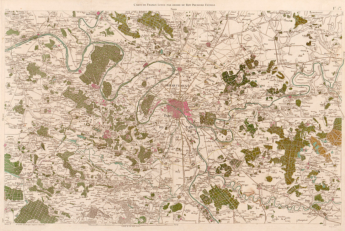
| Map of Paris,published in 1788,by Cesar Francois Cassini de Thury. This map was based on triangulation surveys and is part of the second map of France produced by Cassini. In 1744,along with Jacques Phillipe Maraldi,he had published the first accurate national topographical map of the country. The second map was not finished before Cassini's death in 1784,but his work was continued by his son Dominique Cassini | |
| Licence : | Droits gérés |
| Crédit: | Science Photo Library / LIBRARY OF CONGRESS, GEOGRAPHY AND MAP DIVISION |
| Taille de l’image : | 7677 px × 5142 px |
| Model Release : | Non requis |
| Property Release : | Non requis |
| Restrictions : | - |
Prix pour cette image À partir de 45 €
Produit vendu
(Calendrier, Carte postale, Carte de vœux, Impression sur textile, Packaging etc)
À partir de 45 €
Usage commercial
(Affichage, Annonce presse, Annonce TV, Carte, Digital - hors rés. sociaux, Digital - rés. sociaux etc)
À partir de 45 €
Éditorial
(Digital, Journal, Livre, Livre pratique, Magazine, Télévision etc)
À partir de 60 €
Usage non-commercial
(Digital - hors rés. sociaux, Digital - rés. sociaux etc)
À partir de 120 €
Mots clés
- 1700,
- 1780,
- 1788,
- 18ème siècle,
- ancien,
- campagne,
- capital,
- carte,
- cartes,
- cartographie,
- cartographier,
- CESAR FRANCOIS CASSINI DE,
- DOMINIQUE CASSINI,
- Europe,
- européen,
- français,
- France,
- géographie,
- géographique,
- géométrique,
- histoire,
- historique,
- Paris,
- science de la terre,
- sciences,
- Seine,
- topographie,
- topographique,
- triangulation,
- vieux,
- ville,
- XVIIIème siècle