Map of France,1744
Numéro d’image : 11735564
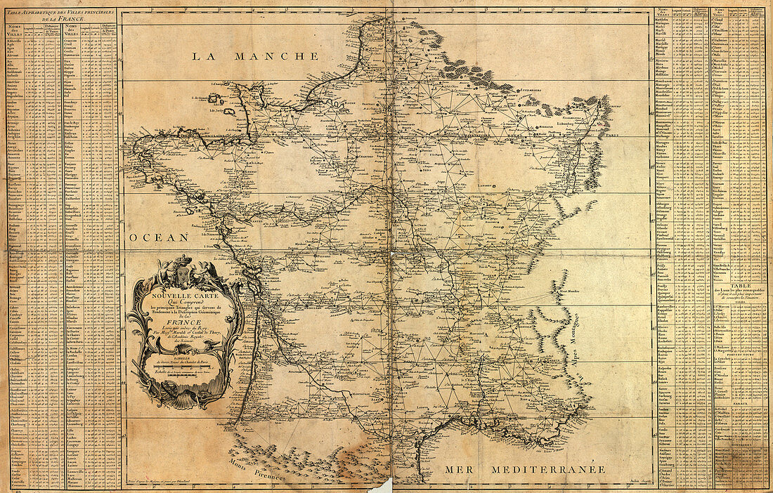
| Map of France,published in 1744 by Jacques Phillipe Maraldi and Cesar Francois Cassini de Thury. This map was based on triangulation surveys and was the first accurate national topographical map of the country. It showed France to be 10 per cent larger than previously thought. The map,which comprised 18 sheets,took three generations of the Cassini family to complete | |
| Licence : | Droits gérés |
| Crédit: | Science Photo Library / LIBRARY OF CONGRESS, GEOGRAPHY AND MAP DIVISION |
| Taille de l’image : | 7677 px × 4900 px |
| Model Release : | Non requis |
| Property Release : | Non requis |
| Restrictions : | - |
Prix pour cette image À partir de 45 €
Produit vendu
(Calendrier, Carte postale, Carte de vœux, Impression sur textile, Packaging etc)
À partir de 45 €
Usage commercial
(Affichage, Annonce presse, Annonce TV, Carte, Digital - hors rés. sociaux, Digital - rés. sociaux etc)
À partir de 45 €
Éditorial
(Digital, Journal, Livre, Livre pratique, Magazine, Télévision etc)
À partir de 60 €
Usage non-commercial
(Digital - hors rés. sociaux, Digital - rés. sociaux etc)
À partir de 120 €
Mots clés
- 1700,
- 1740,
- 1744,
- 18ème siècle,
- ancien,
- carte,
- cartes,
- cartographie,
- cartographier,
- CESAR FRANCOIS CASSINI DE,
- d'abord,
- Europe,
- européen,
- français,
- France,
- géographie,
- géographique,
- géométrique,
- histoire,
- historique,
- JACQUES PHILIPPE MARALDI,
- monochrome,
- national,
- pays,
- science de la terre,
- sciences,
- sépia,
- topographie,
- topographique,
- triangulation,
- vieux,
- XVIIIème siècle