Earth
Numéro d’image : 11735252
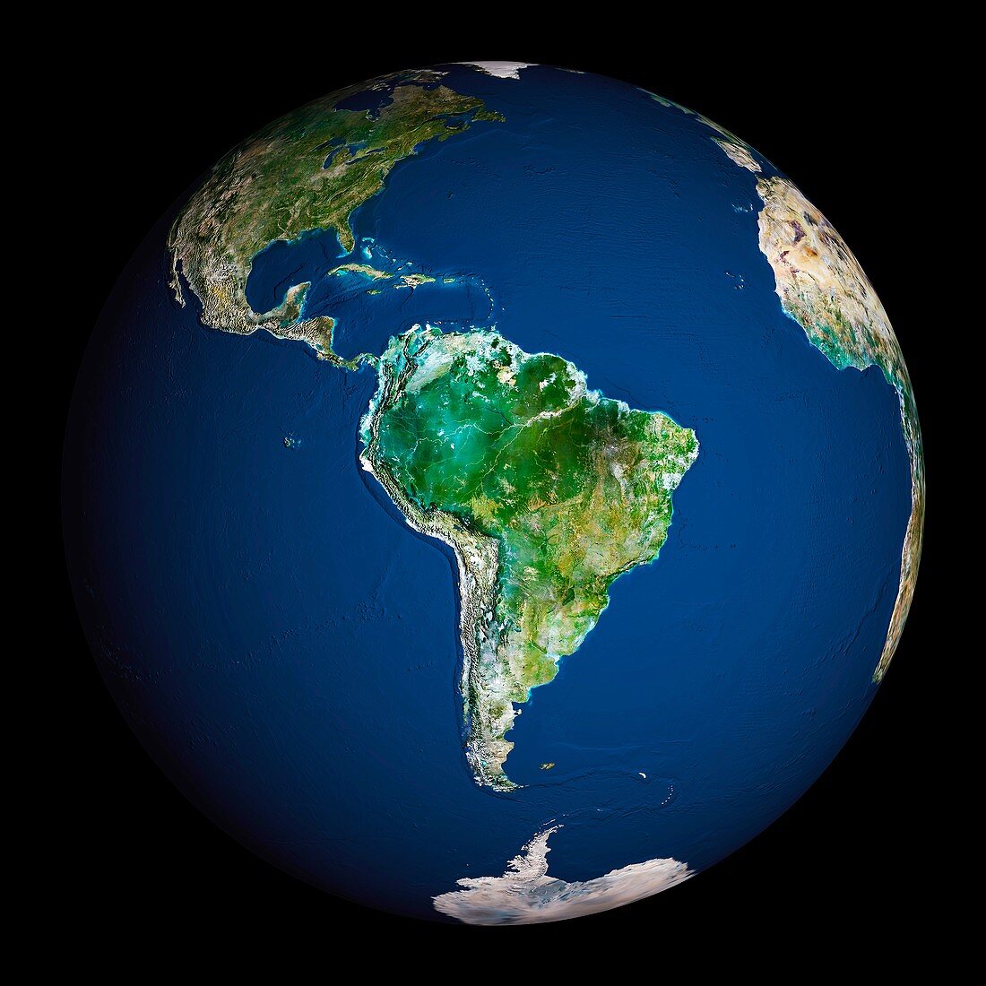
| Earth. Satellite image of the Earth,centred on South America. North is at top. Water is blue,vegetation is green,arid areas are brown,and snow and ice are white. Both land and ocean floor topography are shown. The terrain of South America is marked by the Andes mountains along the western coast,tropical rainforests (dark green) in the Amazon river basin in the north,and swamps and plains (lighter green) in the south. Surrounding South America (clockwise from upper left) is North America and the Caribbean islands,the Atlantic Ocean (right) and the Pacific Ocean (left). Parts of Greenland,Europe,Africa and Antarctica are also seen on the edges of the globe | |
| Licence : | Droits gérés |
| Crédit: | Science Photo Library / Planetobserver |
| Taille de l’image : | 5433 px × 5433 px |
| Model Release : | Non requis |
| Property Release : | Non requis |
| Restrictions : | - |
Prix pour cette image À partir de 45 €
Produit vendu
(Calendrier, Carte postale, Carte de vœux, Impression sur textile, Packaging etc)
À partir de 45 €
Usage commercial
(Affichage, Annonce presse, Annonce TV, Carte, Digital - hors rés. sociaux, Digital - rés. sociaux etc)
À partir de 45 €
Éditorial
(Digital, Journal, Livre, Livre pratique, Magazine, Télévision etc)
À partir de 60 €
Usage non-commercial
(Digital - hors rés. sociaux, Digital - rés. sociaux etc)
À partir de 120 €
Mots clés
- Amazone,
- Amérique Centrale,
- Amérique du Sud,
- Argentine,
- Atlantique,
- Brésil,
- caraïbes,
- cercle,
- circulaire,
- continent,
- continental,
- de l'espace,
- déserts,
- eau,
- entier,
- forêt tropicale,
- forêts,
- géographie,
- géographique,
- global,
- globe,
- hémisphère,
- image satellite,
- Les Andes,
- mer,
- montagnes,
- observation de la terre,
- océan,
- pacifique,
- planète,
- rond,
- satellite,
- sphère,
- sphérique,
- Sud Américain,
- Sud-Américain,
- terre