Earth
Numéro d’image : 11735250
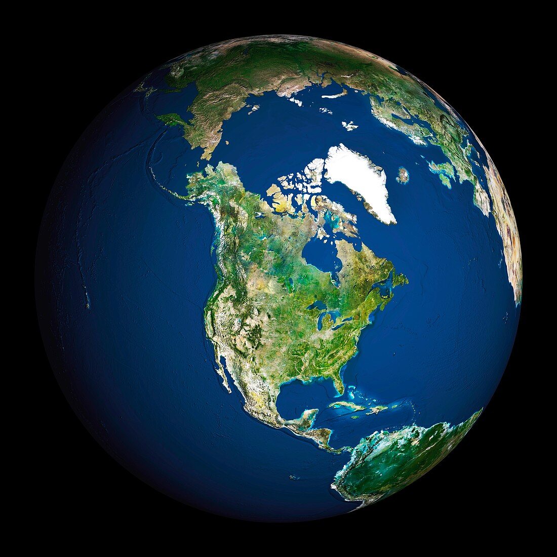
| Earth. Satellite image of the Earth,centred on North America. The North Pole is at upper centre. Water is blue,vegetation is green,arid areas are brown,and snow and ice are white. Both land and ocean floor topography are shown. The terrain of North America is marked by mountain ranges on the western coast,deserts in the south-west,and large lakes in the north-east. The shades of green vary,showing central plains,marshes in the far north,swamps in the south-east and forests in the north-west. Surrounding North America (clockwise from top) is the Arctic Ocean,Greenland,and the Atlantic Ocean (beyond which are Asia,Europe and Africa),South America and the Pacific Ocean | |
| Licence : | Droits gérés |
| Crédit: | Science Photo Library / Planetobserver |
| Taille de l’image : | 5433 px × 5433 px |
| Model Release : | Non requis |
| Property Release : | Non requis |
| Restrictions : | - |
Prix pour cette image À partir de 45 €
Produit vendu
(Calendrier, Carte postale, Carte de vœux, Impression sur textile, Packaging etc)
À partir de 45 €
Usage commercial
(Affichage, Annonce presse, Annonce TV, Carte, Digital - hors rés. sociaux, Digital - rés. sociaux etc)
À partir de 45 €
Éditorial
(Digital, Journal, Livre, Livre pratique, Magazine, Télévision etc)
À partir de 60 €
Usage non-commercial
(Digital - hors rés. sociaux, Digital - rés. sociaux etc)
À partir de 120 €
Mots clés
- américain,
- Amérique Centrale,
- Amérique du Nord,
- Arctique,
- Atlantique,
- Canada,
- caraïbes,
- cercle,
- circulaire,
- continent,
- continental,
- de l'espace,
- déserts,
- eau,
- entier,
- Etats-Unis,
- forêts,
- géographie,
- géographique,
- global,
- globe,
- Groenland,
- hémisphère,
- image satellite,
- lacs,
- mer,
- Mexique,
- montagnes,
- N/A,
- nord américain,
- nord-américain,
- observation de la terre,
- océan,
- pacifique,
- planète,
- rond,
- satellite,
- sphère,
- sphérique,
- terre,
- US,
- USA