Whole Earth map
Numéro d’image : 11735106
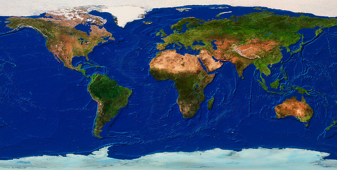
| Whole Earth map. True-colour satellite map of the Earth's land cover and ocean floor topography. The map is centred around the Greenwich Meridian and North is at top. Vegetation is green,water is blue,arid areas are brown and snow and ice are white. The vast deserts (brown) of northern Africa are seen just above centre. Ocean topography includes the Mid-Atlantic Ridge (left of centre) and continental shelves. A continental shelf is seen off the shores of the British Isles of north- western Europe (upper centre) | |
| Licence : | Droits gérés |
| Crédit: | Science Photo Library / Worldsat International |
| Taille de l’image : | 5925 px × 2989 px |
| Model Release : | Non requis |
| Property Release : | Non requis |
| Restrictions : |
|
Prix pour cette image À partir de 45 €
Produit vendu
(Calendrier, Carte postale, Carte de vœux, Impression sur textile, Packaging etc)
À partir de 45 €
Usage commercial
(Affichage, Annonce presse, Annonce TV, Carte, Digital - hors rés. sociaux, Digital - rés. sociaux etc)
À partir de 45 €
Éditorial
(Digital, Journal, Livre, Livre pratique, Magazine, Télévision etc)
À partir de 60 €
Usage non-commercial
(Digital - hors rés. sociaux, Digital - rés. sociaux etc)
À partir de 120 €
Mots clés
- Afrique,
- Amérique du Nord,
- Antarctique,
- Antartica,
- Arctique,
- Asie,
- Asie australe,
- Atlantique,
- cartographie,
- continents,
- de l'espace,
- déserts,
- eau,
- Eurasie,
- Europe,
- géographie,
- géographique,
- glace,
- GREENWICH,
- image satellite,
- imagerie satellitaire,
- imagerie satellite,
- images,
- indien,
- mers,
- neige,
- observation,
- océans,
- pacifique,
- photo,
- photos,
- planétaire,
- planète,
- science de la terre,
- sciences,
- Sud,
- terre,
- topographie,
- topographique,
- végétation