Global topography
Numéro d’image : 11735012
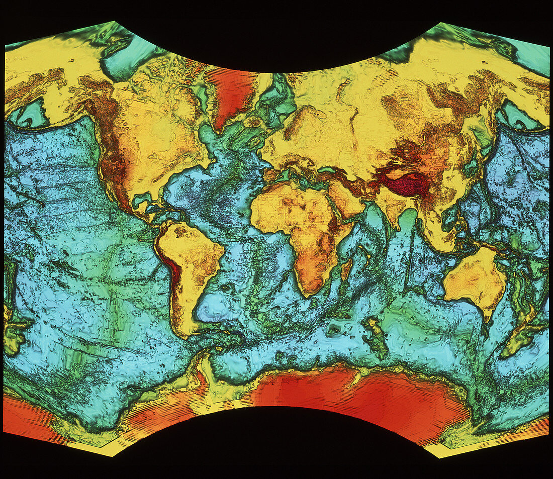
| Global topography. In this view,land masses and associated continental shelves are shown as yellow (lowest),red and brown (highest). Ocean areas are shown as green (shallowest) and blue (deepest). Detailed topographic features are shown by shaded relief. The map is presented in a modified Van der Grinten projection | |
| Licence : | Droits gérés |
| Crédit: | Science Photo Library / NRSC / BP |
| Taille de l’image : | 4108 px × 3559 px |
| Model Release : | Non requis |
| Property Release : | Non requis |
| Restrictions : | - |
Prix pour cette image À partir de 45 €
Produit vendu
(Calendrier, Carte postale, Carte de vœux, Impression sur textile, Packaging etc)
À partir de 45 €
Usage commercial
(Affichage, Annonce presse, Annonce TV, Carte, Digital - hors rés. sociaux, Digital - rés. sociaux etc)
À partir de 45 €
Éditorial
(Digital, Journal, Livre, Livre pratique, Magazine, Télévision etc)
À partir de 60 €
Usage non-commercial
(Digital - hors rés. sociaux, Digital - rés. sociaux etc)
À partir de 120 €