GeoSphere map of ocean floor
Numéro d’image : 11735006
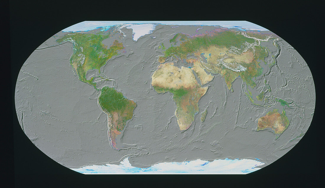
| GeoSphere mapping of ocean floor. Computer- generated view of the Earth,in Robinson projection,centred on the Atlantic Ocean. Here,land cover information taken from satellite images has been merged with an ocean topography map from the US Geological Survey. The shading highlights many features of the ocean. These include the major spreading zones,such as the Mid-Atlantic Ridge and the complex system of ridges in the Indian Ocean. Also seen are the dark lines of the trenches on the edge of the Pacific plate. Many continental shelves are also evident | |
| Licence : | Droits gérés |
| Crédit: | Science Photo Library / GEOSPHERE PROJECT, SANTA MONICA / COPYRIGHT TOM VAN SANT |
| Taille de l’image : | 5617 px × 3249 px |
| Model Release : | Non requis |
| Property Release : | Non requis |
| Restrictions : |
|
Prix pour cette image À partir de 45 €
Produit vendu
(Calendrier, Carte postale, Carte de vœux, Impression sur textile, Packaging etc)
À partir de 45 €
Usage commercial
(Affichage, Annonce presse, Annonce TV, Carte, Digital - hors rés. sociaux, Digital - rés. sociaux etc)
À partir de 45 €
Éditorial
(Digital, Journal, Livre, Livre pratique, Magazine, Télévision etc)
À partir de 60 €
Usage non-commercial
(Digital - hors rés. sociaux, Digital - rés. sociaux etc)
À partir de 120 €