Greenland ice melt,1990
Numéro d’image : 11701529
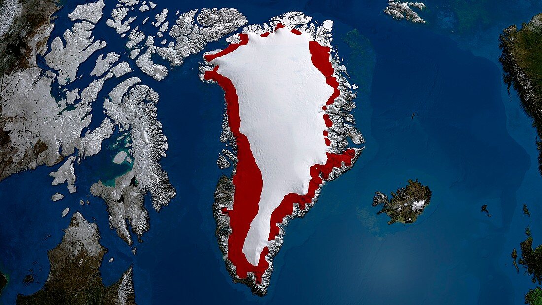
| Greenland ice melt,1990. The ice sheet melt extent is a daily estimate of the spatial extent of wet snow on the Greenland ice sheet,and is derived from passive microwave satellite brightness temperature measurements. This is representative of the amount of ice loss due to seasonal melting. This image shows (in red) the regions of the Greenland ice sheet over which melt occurred for more than three days in 1990 between 1 May and 30 September | |
| Licence : | Droits gérés |
| Crédit: | Science Photo Library / GSFC-SVS / NASA |
| Taille de l’image : | 3945 px × 2219 px |
| Model Release : | Non requis |
| Property Release : | Non requis |
| Restrictions : | - |
Prix pour cette image À partir de 45 €
Produit vendu
(Calendrier, Carte postale, Carte de vœux, Impression sur textile, Packaging etc)
À partir de 45 €
Usage commercial
(Affichage, Annonce presse, Annonce TV, Carte, Digital - hors rés. sociaux, Digital - rés. sociaux etc)
À partir de 45 €
Éditorial
(Digital, Journal, Livre, Livre pratique, Magazine, Télévision etc)
À partir de 60 €
Usage non-commercial
(Digital - hors rés. sociaux, Digital - rés. sociaux etc)
À partir de 120 €
Mots clés
- 1900,
- 1990,
- 20ème siècle,
- Arctique,
- aucun,
- changement climatique,
- climatologie,
- climatologique,
- de l'espace,
- faire fondre,
- fondre,
- fonte des glaces,
- fusion,
- géographie,
- géographique,
- glace,
- Groenland,
- île,
- image satellite,
- micro-ondes,
- moyenne,
- neige,
- observation de la terre,
- personne,
- perte de glace,
- polaire,
- radar,
- réchauffement climatique,
- saison,
- saisonnier,
- satellite,
- XXème siècle