Elba,Italy,satellite image
Numéro d’image : 11698886
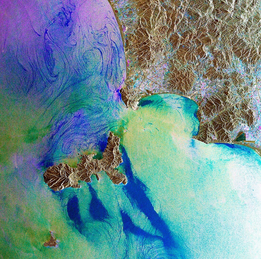
| Elba,Italy,satellite image. North is at top. Elba (lower left) is an island of Elba off Italy's north-western coast. To the east (upper right) is the Italian mainland and region of Tuscany,while the small island of Pianosa is at bottom left. This image is a compilation of three images from the radar sensor of the Envisat satellite,acquired on 29 November 2008,7 February 2009 and 21 August 2010. The images are assigned a colour (red,green and blue) and combined to reveal changes in the surface. The populated areas (multi-coloured) on Italy's mainland show that the land,buildings and roads changed over the three-year period. Changes in the sea surface are also shown | |
| Licence : | Droits gérés |
| Crédit: | Science Photo Library / ESA |
| Taille de l’image : | 3000 px × 2981 px |
| Model Release : | Non requis |
| Property Release : | Non requis |
| Restrictions : |
|
Prix pour cette image À partir de 45 €
Produit vendu
(Calendrier, Carte postale, Carte de vœux, Impression sur textile, Packaging etc)
À partir de 45 €
Usage commercial
(Affichage, Annonce presse, Annonce TV, Carte, Digital - hors rés. sociaux, Digital - rés. sociaux etc)
À partir de 45 €
Éditorial
(Digital, Journal, Livre, Livre pratique, Magazine, Télévision etc)
À partir de 60 €
Usage non-commercial
(Digital - hors rés. sociaux, Digital - rés. sociaux etc)
À partir de 120 €
Mots clés
- 2008,
- 2009,
- 2010,
- 21ème siècle,
- aucun,
- composite,
- côte,
- côtier,
- de l'espace,
- eau,
- Elbe,
- environnement,
- environnemental,
- Envisat,
- Europe,
- européen,
- géographie,
- géographique,
- île,
- île d'Elbe,
- image satellite,
- Italie,
- Italien,
- littoral,
- méditérranéen,
- mer,
- Mer Méditérrannée,
- nature,
- observation de la terre,
- océan,
- personne,
- PIANOSA,
- radar,
- satellite,
- Toscane,
- XX1ème siècle