Kings Canyon,Australia,satellite image
Numéro d’image : 11682496
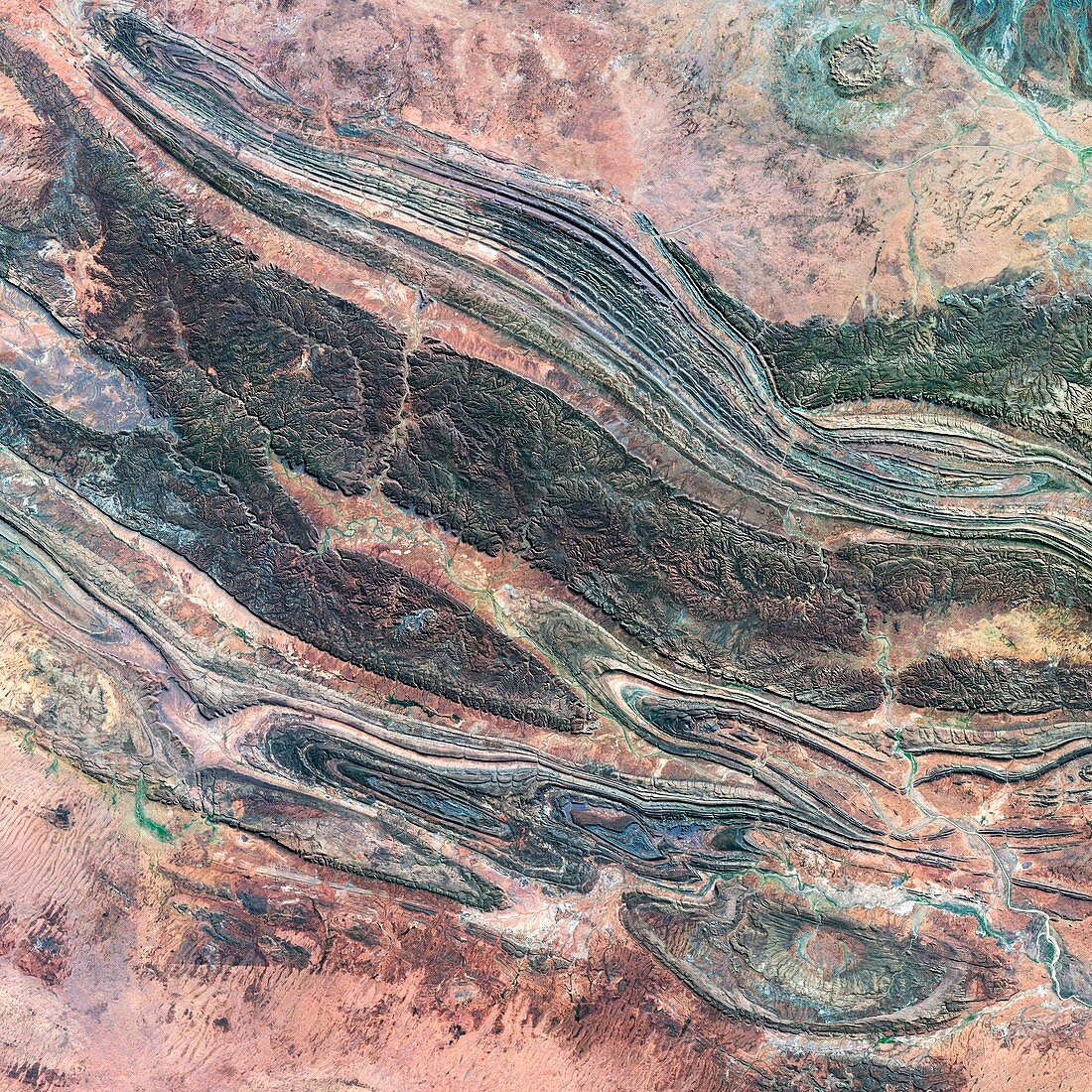
| Kings Canyon,Australia,satellite image. Kings Canyon is part of the Watarrka National Park in Northern Territory,Australia. The sandstone landscape was formed around 440 million years ago and the canyon was carved by water erosion from ancient lakes and rivers. The tallest canyon walls can reach 270 metres. Image taken in June 2014 by the OLI (Operational Land Imager) on board the Landsat 8 space satellite. This image covers an area measuring 89 kilometres squared | |
| Licence : | Droits gérés |
| Crédit: | Science Photo Library / US Geological Survey |
| Taille de l’image : | 2966 px × 2966 px |
| Model Release : | Non requis |
| Property Release : | Non requis |
| Restrictions : | - |
Prix pour cette image À partir de 45 €
Produit vendu
(Calendrier, Carte postale, Carte de vœux, Impression sur textile, Packaging etc)
À partir de 45 €
Usage commercial
(Affichage, Annonce presse, Annonce TV, Carte, Digital - hors rés. sociaux, Digital - rés. sociaux etc)
À partir de 45 €
Éditorial
(Digital, Journal, Livre, Livre pratique, Magazine, Télévision etc)
À partir de 60 €
Usage non-commercial
(Digital - hors rés. sociaux, Digital - rés. sociaux etc)
À partir de 120 €
Mots clés
- 21ème siècle,
- Australie,
- australien,
- canyon,
- carte,
- cartographie,
- cartographier,
- enquête,
- érosion,
- géographie,
- géographique,
- géologie,
- géologique,
- gorge,
- huiles,
- image satellite,
- imageur terrestre opérationnel,
- infrarouge,
- landsat 8,
- landsat huit,
- LDCM,
- observation de la terre,
- OLI,
- Operational Land Imager,
- relief,
- rivière,
- satellite,
- sol,
- sondage,
- spectre visible,
- terrain,
- terrestre,
- territoires du Nord,
- XX1ème siècle