Cotahuasi Canyon,Peru,satellite image
Numéro d’image : 11682491
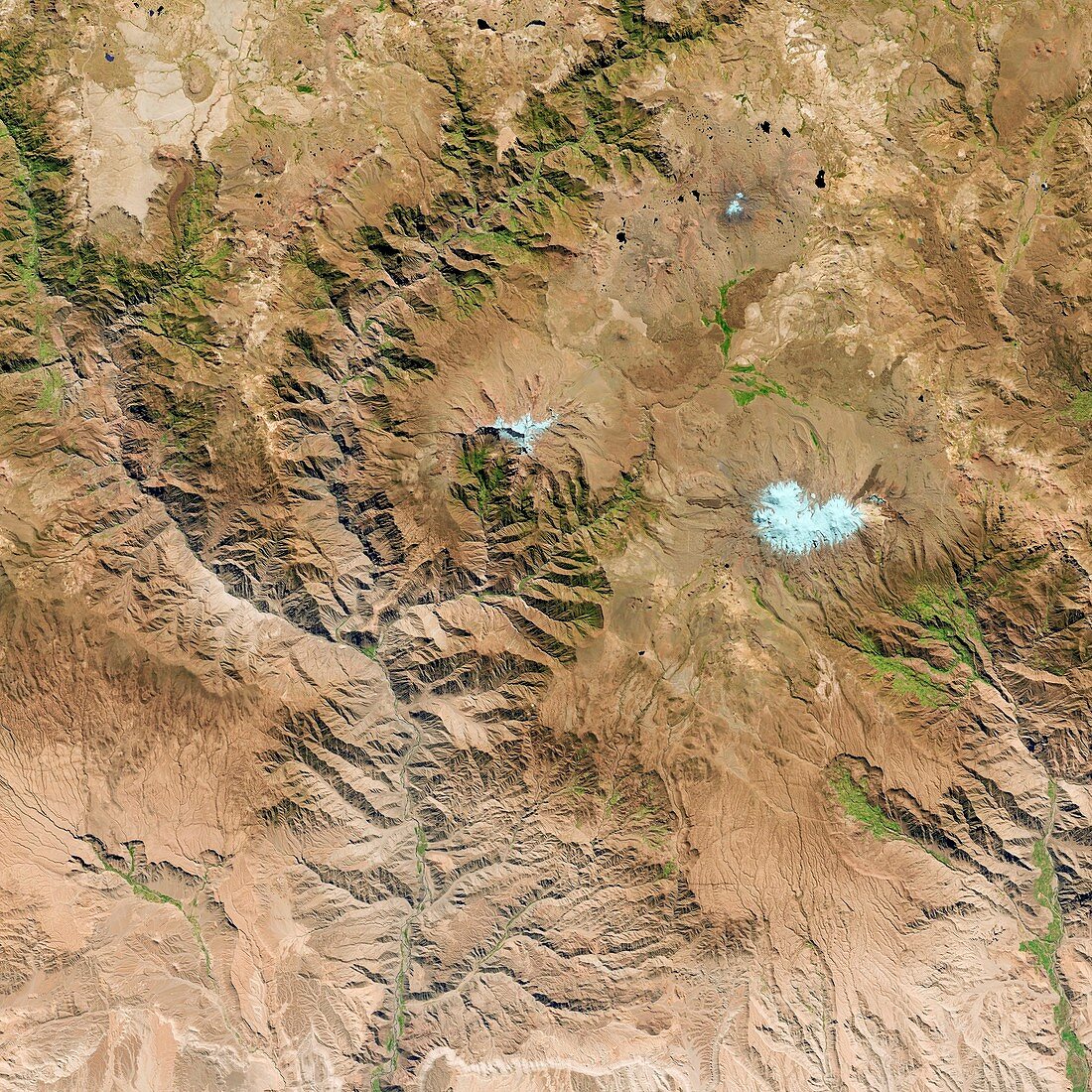
| Cotahuasi Canyon,Peru,satellite image. This canyon was cut by the eroding action of the Rio Cotahuasi. Image taken in May 2014 by the OLI (Operational Land Imager) on board the Landsat 8 space satellite. This image covers an area measuring 117 kilometres squared | |
| Licence : | Droits gérés |
| Crédit: | Science Photo Library / US Geological Survey |
| Taille de l’image : | 2967 px × 2966 px |
| Model Release : | Non requis |
| Property Release : | Non requis |
| Restrictions : | - |
Prix pour cette image À partir de 45 €
Produit vendu
(Calendrier, Carte postale, Carte de vœux, Impression sur textile, Packaging etc)
À partir de 45 €
Usage commercial
(Affichage, Annonce presse, Annonce TV, Carte, Digital - hors rés. sociaux, Digital - rés. sociaux etc)
À partir de 45 €
Éditorial
(Digital, Journal, Livre, Livre pratique, Magazine, Télévision etc)
À partir de 60 €
Usage non-commercial
(Digital - hors rés. sociaux, Digital - rés. sociaux etc)
À partir de 120 €
Mots clés
- 21ème siècle,
- canyon,
- carte,
- cartographie,
- cartographier,
- enquête,
- érosion,
- géographie,
- géographique,
- géologie,
- géologique,
- gorge,
- huiles,
- image satellite,
- imageur terrestre opérationnel,
- infrarouge,
- landsat 8,
- landsat huit,
- LDCM,
- observation de la terre,
- OLI,
- Operational Land Imager,
- Pérou,
- relief,
- rivière,
- satellite,
- sol,
- sondage,
- spectre visible,
- terrain,
- terrestre,
- XX1ème siècle