Copper Canyon,Mexico,satellite image
Numéro d’image : 11682490
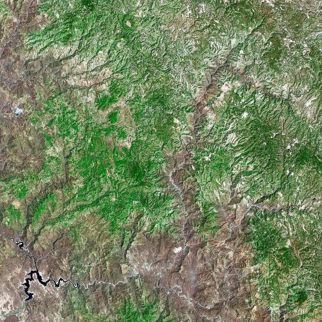
| Copper Canyon,Mexico,satellite image. The Copper Canyon (Barranca del Cobre in Spanish)is so called because of the green copper tinge in the rocks. This group of canyons were formed by the eroding action of six rivers. Image taken in April 2014 by the OLI (Operational Land Imager) on board the Landsat 8 space satellite. This image covers an area measuring 100 kilometres squared | |
| Licence : | Droits gérés |
| Crédit: | Science Photo Library / US Geological Survey |
| Taille de l’image : | 2968 px × 2968 px |
| Model Release : | Non requis |
| Property Release : | Non requis |
| Restrictions : | - |
Prix pour cette image À partir de 45 €
Produit vendu
(Calendrier, Carte postale, Carte de vœux, Impression sur textile, Packaging etc)
À partir de 45 €
Usage commercial
(Affichage, Annonce presse, Annonce TV, Carte, Digital - hors rés. sociaux, Digital - rés. sociaux etc)
À partir de 45 €
Éditorial
(Digital, Journal, Livre, Livre pratique, Magazine, Télévision etc)
À partir de 60 €
Usage non-commercial
(Digital - hors rés. sociaux, Digital - rés. sociaux etc)
À partir de 120 €
Mots clés
- 21ème siècle,
- Amérique du Nord,
- canyon,
- carte,
- cartographie,
- cartographier,
- enquête,
- érosion,
- géographie,
- géographique,
- géologie,
- géologique,
- gorge,
- huiles,
- image satellite,
- imageur terrestre opérationnel,
- infrarouge,
- landsat 8,
- landsat huit,
- LDCM,
- Mexique,
- observation de la terre,
- OLI,
- Operational Land Imager,
- relief,
- rivière,
- satellite,
- sol,
- sondage,
- spectre visible,
- terrain,
- terrestre,
- XX1ème siècle