Dust storm over the Aral sea
Numéro d’image : 11679138
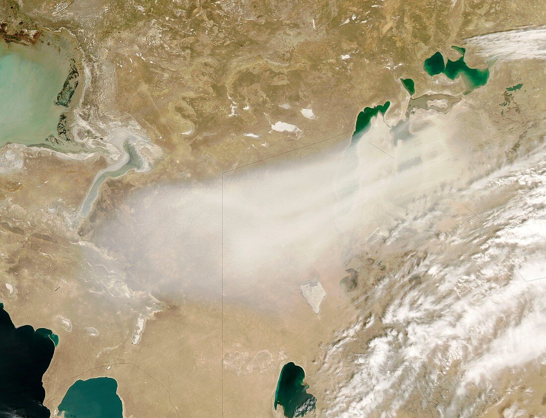
| Satellite image of a dust storm over the Aral sea. The Aral sea lies between Kazakhstan in the north and Uzbekistan in the south. Once one of the largest lakes on Earth,it has been steadily shrinking since the 1960s,after the rivers that fed it were diverted by Soviet irrigation projects. Image taken in April 2008,by NASA's MODIS (moderate resolution imaging spectroradiometer) aboard the Aqua (EOS PM) satellite | |
| Licence : | Droits gérés |
| Crédit: | Science Photo Library / Jeff Schmaltz / NASA |
| Taille de l’image : | 3400 px × 2600 px |
| Model Release : | Non requis |
| Property Release : | Non requis |
| Restrictions : | - |
Prix pour cette image À partir de 45 €
Produit vendu
(Calendrier, Carte postale, Carte de vœux, Impression sur textile, Packaging etc)
À partir de 45 €
Usage commercial
(Affichage, Annonce presse, Annonce TV, Carte, Digital - hors rés. sociaux, Digital - rés. sociaux etc)
À partir de 45 €
Éditorial
(Digital, Journal, Livre, Livre pratique, Magazine, Télévision etc)
À partir de 60 €
Usage non-commercial
(Digital - hors rés. sociaux, Digital - rés. sociaux etc)
À partir de 120 €
Mots clés
- 2000,
- 2008,
- 21ème siècle,
- aquatique,
- asiatique,
- Asie,
- aucun,
- de l'espace,
- eau,
- EOS,
- Eurasie,
- géographie,
- géographique,
- image satellite,
- Kazakhstan,
- lac,
- mer,
- Mer d'Aral,
- météo,
- météorologie,
- météorologique,
- modis,
- NASA,
- observation de la terre,
- Ouzbékistan,
- personne,
- rétrécir,
- satellite,
- spectroradiomètre imageur à résolution moyenne,
- tempête de sable,
- XX1ème siècle