Thames Valley flooding,2014
Numéro d’image : 11675304
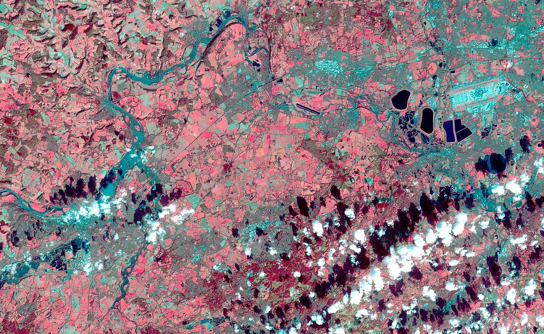
| Thames Valley flooding. Satellite image of flooding in the Thames Valley,UK. The River Thames is deep turquoise,vegetation is red,clouds are white,and their shadows are black. Heavy rainfall from December 2013 to February 2014 caused the highest water levels seen in the Thames since records began. It burst it banks at several locations in Surrey in Berkshire,putting thousands of homes at risk. Image obtained by the ASTER (Advanced Spaceborne Thermal Emission and Reflection Radiometer) instrument on NASA's Terra satellite on 16th February 2014 | |
| Licence : | Droits gérés |
| Crédit: | Science Photo Library / JAROS / ERSDAC / METI / GSFC / NASA |
| Taille de l’image : | 3780 px × 2324 px |
| Model Release : | Non requis |
| Property Release : | Non requis |
| Restrictions : | - |
Prix pour cette image À partir de 45 €
Produit vendu
(Calendrier, Carte postale, Carte de vœux, Impression sur textile, Packaging etc)
À partir de 45 €
Usage commercial
(Affichage, Annonce presse, Annonce TV, Carte, Digital - hors rés. sociaux, Digital - rés. sociaux etc)
À partir de 45 €
Éditorial
(Digital, Journal, Livre, Livre pratique, Magazine, Télévision etc)
À partir de 60 €
Usage non-commercial
(Digital - hors rés. sociaux, Digital - rés. sociaux etc)
À partir de 120 €
Mots clés
- 2000,
- 2010,
- 21ème siècle,
- anglais,
- Angleterre,
- aster,
- Berkshire,
- britannique,
- catastrophe naturelle,
- Europe,
- européen,
- géographie,
- géographique,
- Grande-Bretagne,
- image satellite,
- inondation,
- inondations,
- inondé,
- la Tamise,
- observation de la terre,
- radiomètre spatial à émission thermique et à reflexion de pointe,
- rivière,
- Royaume Uni,
- Royaume-Uni,
- satellite,
- Sud-Est,
- Surrey,
- terra,
- terre,
- XX1ème siècle