Global fire map,August 2013
Numéro d’image : 11674780
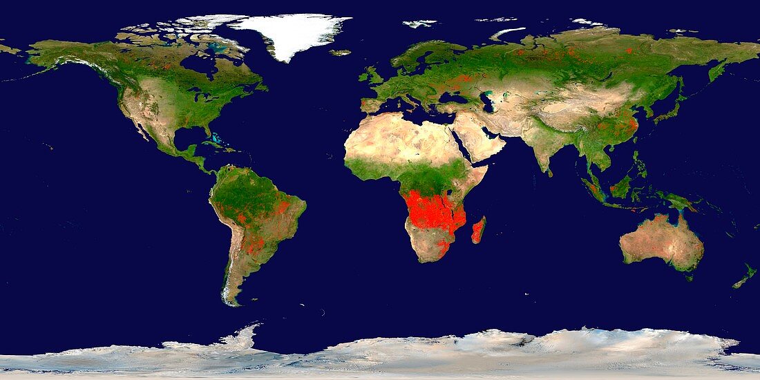
| Global fire map. Fire map compiled from satellite data showing every fire detected between 9th and 18th August 2013. Red areas have a low fire count,yellow areas have a large number of fires.The majority of the fires are agricultural or wildfires. The fires were detected by the MODIS (Moderate Resolution Imaging Spectroradiometer) sensors on NASA's Earth Observing System satellites (Terra and Aqua) | |
| Licence : | Droits gérés |
| Crédit: | Science Photo Library / NASA |
| Taille de l’image : | 6491 px × 3246 px |
| Model Release : | Non requis |
| Property Release : | Non requis |
| Restrictions : | - |
Prix pour cette image À partir de 45 €
Produit vendu
(Calendrier, Carte postale, Carte de vœux, Impression sur textile, Packaging etc)
À partir de 45 €
Usage commercial
(Affichage, Annonce presse, Annonce TV, Carte, Digital - hors rés. sociaux, Digital - rés. sociaux etc)
À partir de 45 €
Éditorial
(Digital, Journal, Livre, Livre pratique, Magazine, Télévision etc)
À partir de 60 €
Usage non-commercial
(Digital - hors rés. sociaux, Digital - rés. sociaux etc)
À partir de 120 €
Mots clés
- 21ème siècle,
- africain,
- Afrique,
- Amérique du Nord,
- Amérique du Sud,
- Amérique Latine,
- aquatique,
- asiatique,
- Asie,
- Asie australe,
- carte,
- dans le monde entier,
- déboisement,
- défricher,
- eau,
- entier,
- Europe,
- européen,
- feu,
- feu de forêt,
- feux,
- géographie,
- géographique,
- global,
- image satellite,
- modis,
- mondial,
- nord américain,
- nord-américain,
- observation de la terre,
- oceania,
- Océanie,
- projection plane,
- satellite,
- terra,
- terre,
- XX1ème siècle