Milton Keynes,aerial photograph
Numéro d’image : 11654786
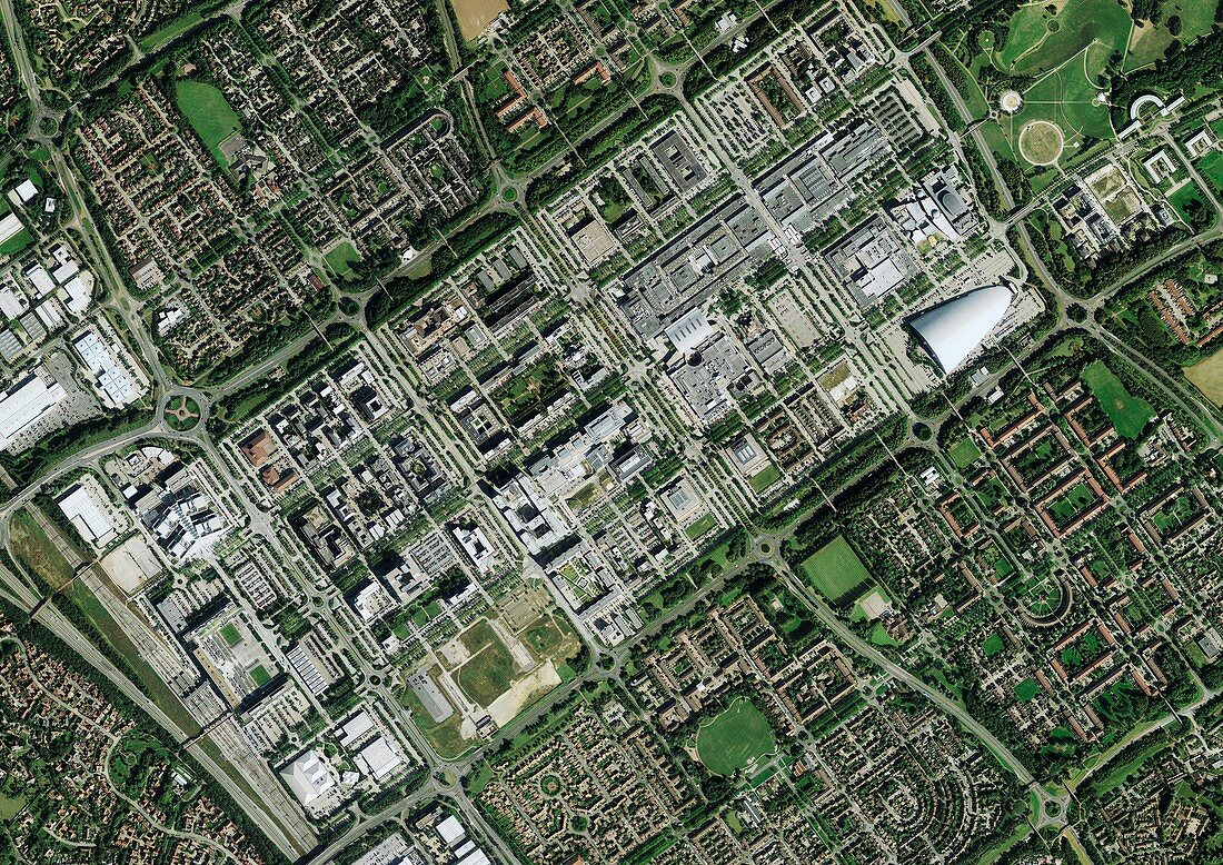
| Milton Keynes,aerial photograph. The main rectangular portion of the image shows the shopping district in central Milton Keynes. It is surrounded by residential housing. Roads are arranged in a grid pattern. The large white building (middle right) is the XScape Centre and Milton Keynes Central Station is at bottom left corner. Milton Keynes existed formerly as a series of small villages set in farmland. During the 1960's the area experienced rapid new housing development with the aim to build a new city. Photographed in 2012 | |
| Licence : | Droits gérés |
| Crédit: | Science Photo Library / Getmapping Plc |
| Taille de l’image : | 4986 px × 3528 px |
| Model Release : | Non requis |
| Property Release : | Non requis |
| Restrictions : | - |
Prix pour cette image À partir de 45 €
Produit vendu
(Calendrier, Carte postale, Carte de vœux, Impression sur textile, Packaging etc)
À partir de 45 €
Usage commercial
(Affichage, Annonce presse, Annonce TV, Carte, Digital - hors rés. sociaux, Digital - rés. sociaux etc)
À partir de 45 €
Éditorial
(Digital, Journal, Livre, Livre pratique, Magazine, Télévision etc)
À partir de 60 €
Usage non-commercial
(Digital - hors rés. sociaux, Digital - rés. sociaux etc)
À partir de 120 €
Mots clés
- 2012,
- 21ème siècle,
- bâtiment,
- bâtiments,
- carte,
- cartographie,
- cartographier,
- chemin de fer,
- enquête,
- Europe,
- européen,
- immeubles,
- maison,
- maisons,
- moderne,
- observation de la terre,
- photo aérienne,
- photographie aérienne,
- route,
- routes,
- Royaume Uni,
- Royaume-Uni,
- sondage,
- urbain,
- urbanisation,
- ville,
- vue à vol d'oiseau,
- vue aérienne,
- vue d'oeil d'oiseau,
- XX1ème siècle