British Isles,satellite image
Numéro d’image : 11641712
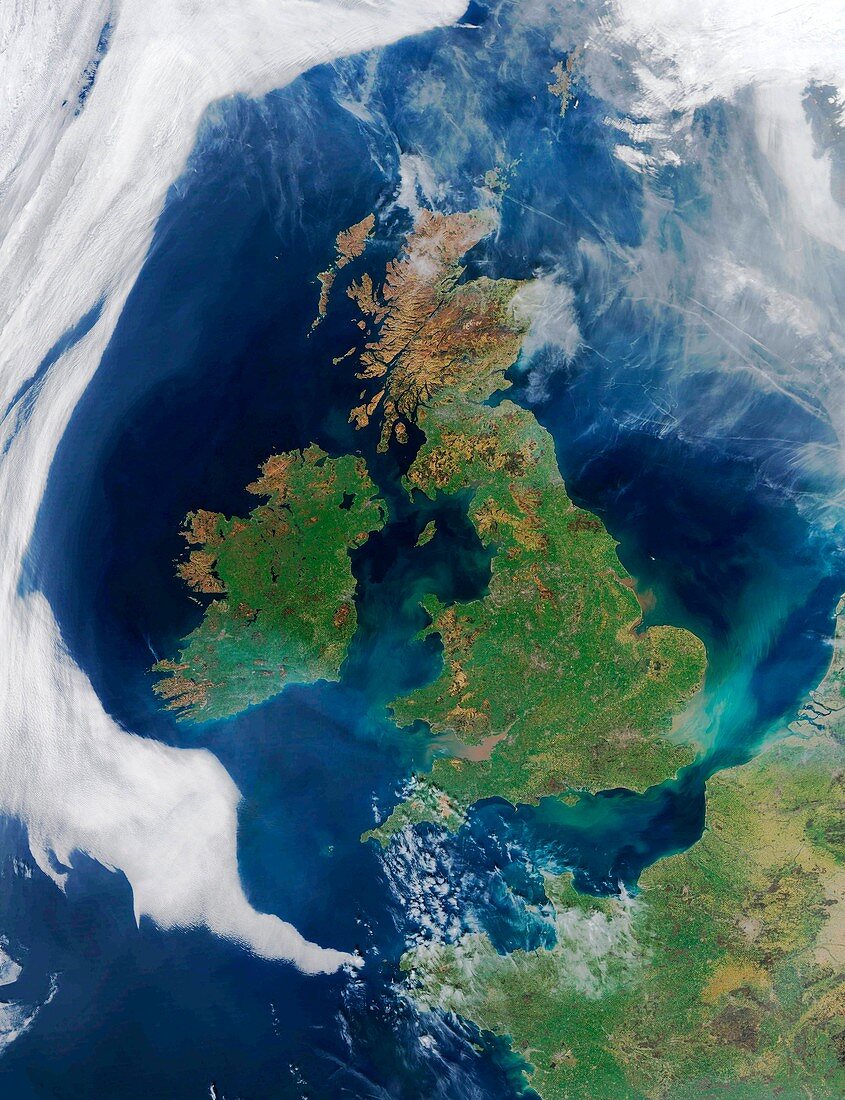
| British Isles,satellite image. North is at top. Sediment from river run-off discolours water around the coast. Aircraft contrails are visible over the North Sea. A smoke plume from a fire in County Kerry (south-west Ireland) disperses over the Atlantic Ocean. Image data obtained on 26 March 2012,with the MODIS (Moderate Resolution Imaging Spectroradiometer) sensor on one of NASA's Earth Observing System satellites (Terra and Aqua) | |
| Licence : | Droits gérés |
| Crédit: | Science Photo Library / University of Dundee |
| Taille de l’image : | 3671 px × 4780 px |
| Model Release : | Non requis |
| Property Release : | Non requis |
| Restrictions : | - |
Prix pour cette image À partir de 45 €
Produit vendu
(Calendrier, Carte postale, Carte de vœux, Impression sur textile, Packaging etc)
À partir de 45 €
Usage commercial
(Affichage, Annonce presse, Annonce TV, Carte, Digital - hors rés. sociaux, Digital - rés. sociaux etc)
À partir de 45 €
Éditorial
(Digital, Journal, Livre, Livre pratique, Magazine, Télévision etc)
À partir de 60 €
Usage non-commercial
(Digital - hors rés. sociaux, Digital - rés. sociaux etc)
À partir de 120 €
Mots clés
- 2012,
- 21ème siècle,
- aquatique,
- Atlantique,
- britannique,
- de l'espace,
- eau,
- EOS,
- Europe,
- européen,
- géographie,
- géographique,
- Grande-Bretagne,
- île,
- image satellite,
- Irlande,
- mer,
- modis,
- nuage,
- nuages,
- observation de la terre,
- océan,
- Royaume Uni,
- Royaume-Uni,
- satellite,
- science de la terre,
- Sciences de la Terre,
- spectroradiomètre imageur à résolution moyenne,
- système d'observation de la terre,
- terra,
- terre,
- XX1ème siècle