Ganges River delta,India
Numéro d’image : 11626919
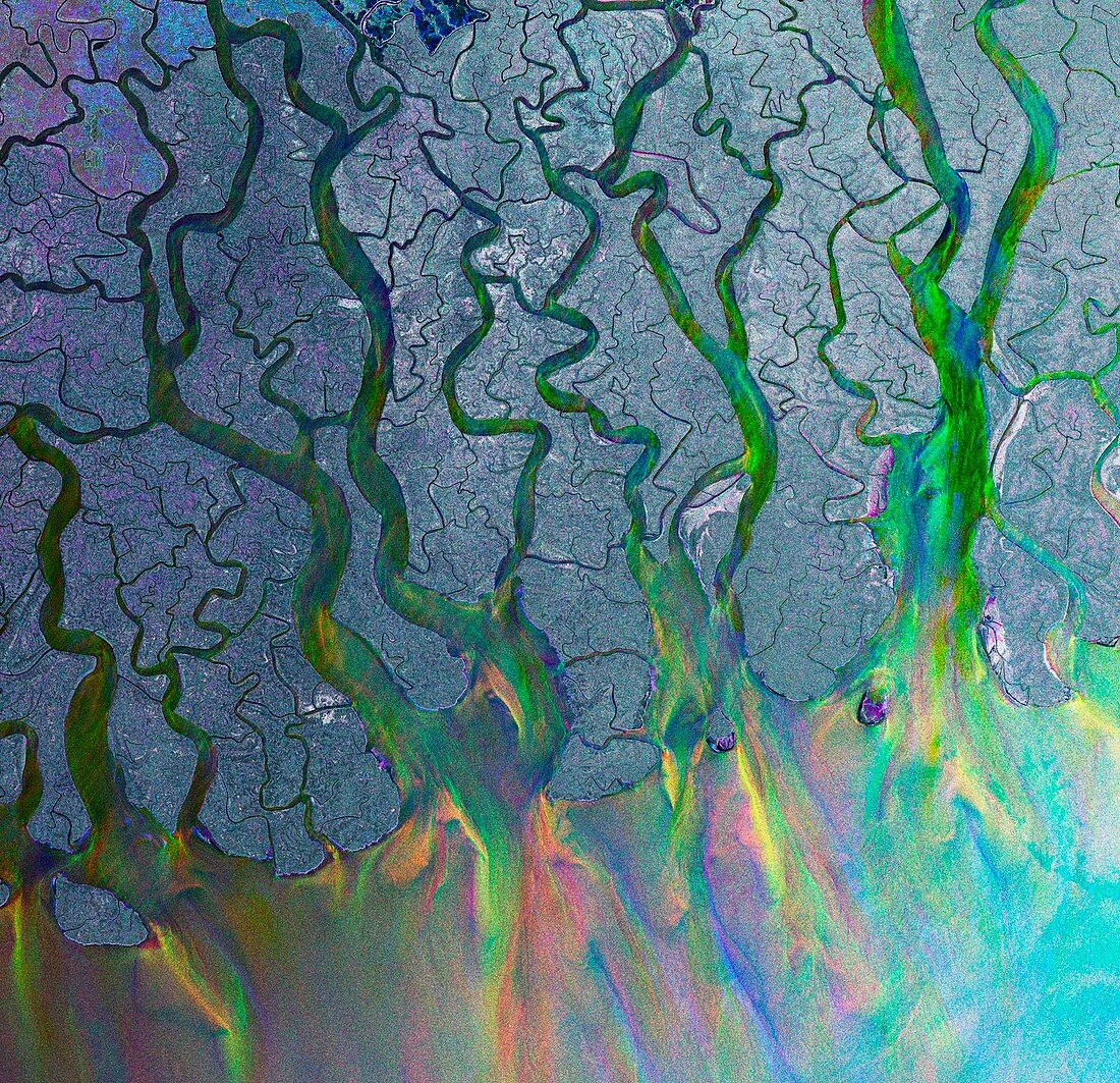
| Ganges delta,India,radar satellite image. The Ganges is a river which flows for over 2400 kilometres from the Himalayas to the Indian Ocean's Bay of Bengal. It carries fertile soil and nutrients,which it deposits in its vast delta floodplain. The silt deposits cover an area,in India and Bangladesh,of 60,000 square kilometres. The delta is highly cultivated and floods every summer during the monsoon season. North is top. Image taken by the ENVISAT satellite using the Advanced Synthetic Aperture Radar in 2009 | |
| Licence : | Droits gérés |
| Crédit: | Science Photo Library / ESA |
| Taille de l’image : | 1999 px × 1932 px |
| Model Release : | Non requis |
| Property Release : | Non requis |
| Restrictions : |
|
Prix pour cette image À partir de 45 €
Produit vendu
(Calendrier, Carte postale, Carte de vœux, Impression sur textile, Packaging etc)
À partir de 45 €
Usage commercial
(Affichage, Annonce presse, Annonce TV, Carte, Digital - hors rés. sociaux, Digital - rés. sociaux etc)
À partir de 45 €
Éditorial
(Digital, Journal, Livre, Livre pratique, Magazine, Télévision etc)
À partir de 60 €
Usage non-commercial
(Digital - hors rés. sociaux, Digital - rés. sociaux etc)
À partir de 120 €