Schrodinger basin,lunar map
Numéro d’image : 11624039
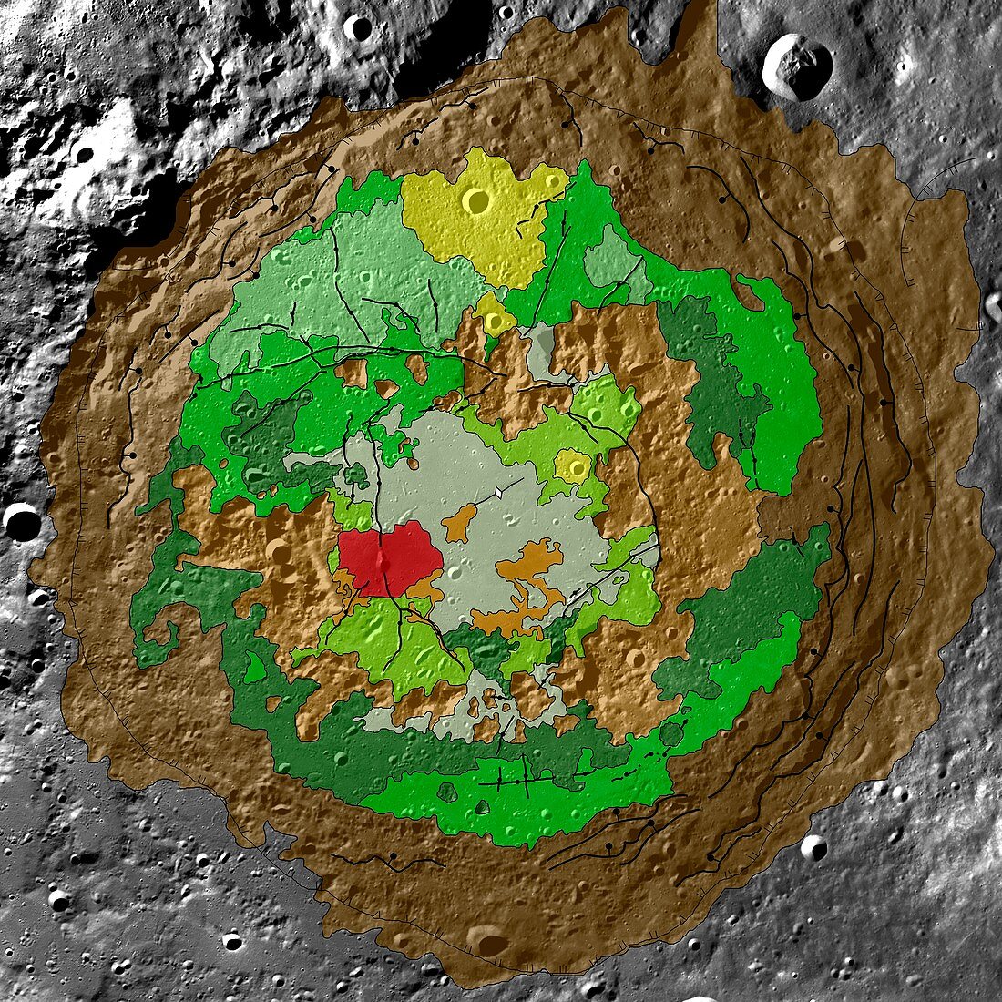
| Schrodinger basin,lunar map. Geologic map of the moon's Schrodinger basin,an impact crater located near the moon's south pole. The crater measures roughly 320 kilometres wide. The map combines topographic data from the Lunar Orbiter Laser Altimeter (from the 2009 Lunar Reconnaissance Orbiter) with data from earlier Clementine and Lunar Prospector missions. Colours represent rock type. The peak ring is coloured brown,recent volcanic activity coloured red,cratering is yellow and plains material is coloured dark and light green | |
| Licence : | Droits gérés |
| Crédit: | Science Photo Library / US Geological Survey |
| Taille de l’image : | 2988 px × 2988 px |
| Model Release : | Non requis |
| Property Release : | Non requis |
| Restrictions : | - |
Prix pour cette image À partir de 45 €
Produit vendu
(Calendrier, Carte postale, Carte de vœux, Impression sur textile, Packaging etc)
À partir de 45 €
Usage commercial
(Affichage, Annonce presse, Annonce TV, Carte, Digital - hors rés. sociaux, Digital - rés. sociaux etc)
À partir de 45 €
Éditorial
(Digital, Journal, Livre, Livre pratique, Magazine, Télévision etc)
À partir de 60 €
Usage non-commercial
(Digital - hors rés. sociaux, Digital - rés. sociaux etc)
À partir de 120 €
Mots clés
- anneau,
- anneaux,
- bassin d'impact,
- carte,
- Clémentine,
- cratère,
- cratères,
- cratérisé,
- débris,
- géologie,
- géologique,
- image satellite,
- lunaire,
- Lunar Reconnaissance Orbiter,
- lune,
- mare crisium,
- mer des crises,
- Mercator,
- orbiteur de reconnaissance lunaire,
- projections,
- satellite,
- science spatiale,
- surface de la lune,
- système solaire,
- topographique,
- zone d'impact