South side of the moon,geologic map
Numéro d’image : 11623966
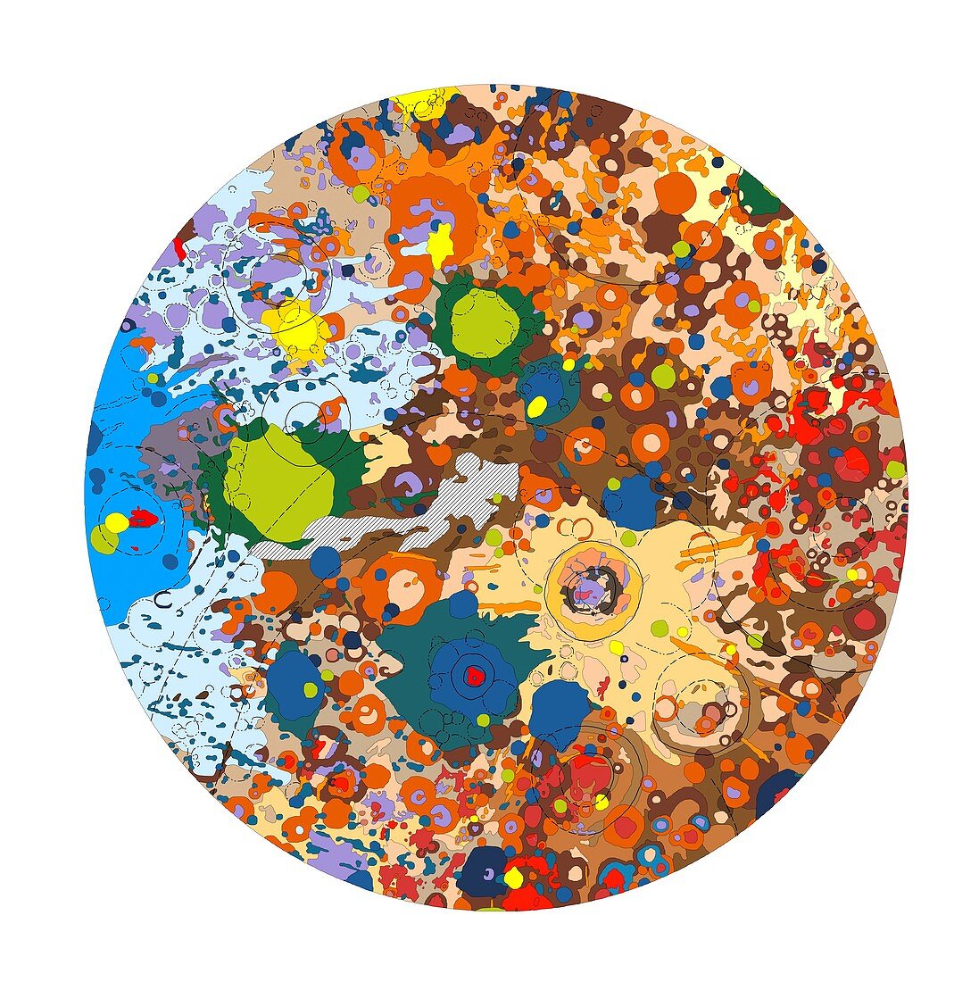
| South side of the moon. Geologic map of the moon based on data collected from the Lunar orbiter,Mariner 10 and Zond 7 spacecraft. Regions are coloured according to reflectivity and correspond to surface features,such as major impact craters,basins,plains,faults,mountains and other landmarks. The upper half of the moon in this view is the near-Earth side and the lower half is the far side of the moon. The lunar south pole (centre middle) does not receive as much sunlight as the lunar north pole. It is thought that permanently unlit craters in this region may hold water ice | |
| Licence : | Droits gérés |
| Crédit: | Science Photo Library / US Geological Survey |
| Taille de l’image : | 4961 px × 4975 px |
| Model Release : | Non requis |
| Property Release : | Non requis |
| Restrictions : | - |
Prix pour cette image À partir de 45 €
Produit vendu
(Calendrier, Carte postale, Carte de vœux, Impression sur textile, Packaging etc)
À partir de 45 €
Usage commercial
(Affichage, Annonce presse, Annonce TV, Carte, Digital - hors rés. sociaux, Digital - rés. sociaux etc)
À partir de 45 €
Éditorial
(Digital, Journal, Livre, Livre pratique, Magazine, Télévision etc)
À partir de 60 €
Usage non-commercial
(Digital - hors rés. sociaux, Digital - rés. sociaux etc)
À partir de 120 €
Mots clés
- anneau,
- anneaux,
- austral,
- bassin d'impact,
- carte,
- cratère,
- cratères,
- cratérisé,
- débris,
- du sud,
- géologie,
- géologique,
- image satellite,
- jument,
- lunaire,
- Lunar orbiter,
- lune,
- mare imbrium,
- polaire,
- Pôle Sud,
- projections,
- satellite,
- science spatiale,
- Sud,
- surface de la lune,
- système solaire,
- topographique,
- zone d'impact