West side of the moon,geologic map
Numéro d’image : 11623738
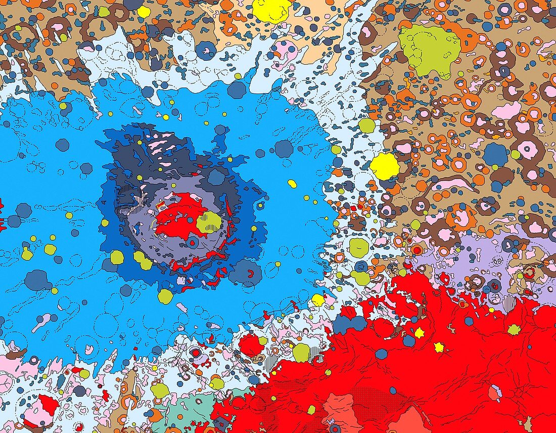
| West side of the moon. Geologic map of the moon based on photographs from the Lunar orbiter spacecraft and albedo (surface reflectivity) data from the Russian Zond 8 spacecraft. Regions are coloured according to reflectivity and correspond to surface features,such as major impact craters,basins,plains,faults,mountains and other landmarks. The large bull's-eye structure (red and blue,left of centre) is the Mare Orientale,an impact basin measuring 900 kilometres across | |
| Licence : | Droits gérés |
| Crédit: | Science Photo Library / US Geological Survey |
| Taille de l’image : | 4760 px × 3706 px |
| Model Release : | Non requis |
| Property Release : | Non requis |
| Restrictions : | - |
Prix pour cette image À partir de 45 €
Produit vendu
(Calendrier, Carte postale, Carte de vœux, Impression sur textile, Packaging etc)
À partir de 45 €
Usage commercial
(Affichage, Annonce presse, Annonce TV, Carte, Digital - hors rés. sociaux, Digital - rés. sociaux etc)
À partir de 45 €
Éditorial
(Digital, Journal, Livre, Livre pratique, Magazine, Télévision etc)
À partir de 60 €
Usage non-commercial
(Digital - hors rés. sociaux, Digital - rés. sociaux etc)
À partir de 120 €