Urban heat island,satellite image
Numéro d’image : 11618143
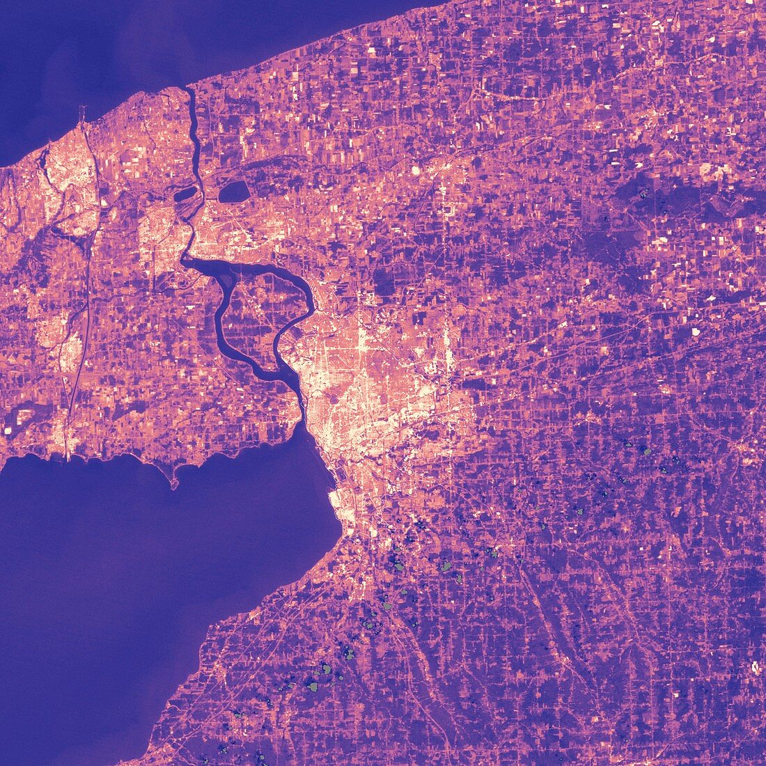
| Urban heat island. Thermal satellite image of Buffalo,New York,USA. Colours indicate surface temperatures,with dark blue coolest,through purple to orange and yellow (hottest). This phenomenon occurs in built-up areas where concrete and other surface materials retain heat for longer than rural areas covered in vegetation or bare ground. Image obtained by the Enhanced Thematic Mapper on NASA's Landsat 7 satellite in August | |
| Licence : | Droits gérés |
| Crédit: | Science Photo Library / NASA |
| Taille de l’image : | 3000 px × 3000 px |
| Model Release : | Non requis |
| Property Release : | Non requis |
| Restrictions : | - |
Prix pour cette image À partir de 45 €
Produit vendu
(Calendrier, Carte postale, Carte de vœux, Impression sur textile, Packaging etc)
À partir de 45 €
Usage commercial
(Affichage, Annonce presse, Annonce TV, Carte, Digital - hors rés. sociaux, Digital - rés. sociaux etc)
À partir de 45 €
Éditorial
(Digital, Journal, Livre, Livre pratique, Magazine, Télévision etc)
À partir de 60 €
Usage non-commercial
(Digital - hors rés. sociaux, Digital - rés. sociaux etc)
À partir de 120 €
Mots clés
- 21ème siècle,
- américain,
- Amérique du Nord,
- bâtie,
- bison,
- buffle,
- climatologie,
- climatologique,
- construite,
- Etats-Unis,
- image satellite,
- landsat 7,
- New York,
- observation de la terre,
- phénomène,
- plus chaleureux,
- plus chaud,
- réchauffement,
- satellite,
- sciences de l'environnement,
- sciences environnementales,
- thermique,
- urbain,
- urbanisation,
- USA,
- ville,
- XX1ème siècle