Polar orbit diagram
Numéro d’image : 11614916
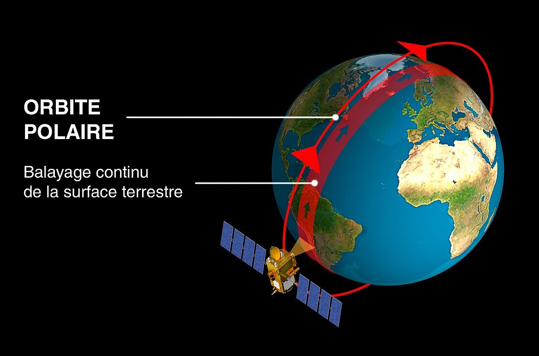
| Polar orbit diagram. This orbit (red circle and arrows) is used for observation and mapping satellites making continuous recordings that over time cover the entire Earth,including the polar regions. The satellite observes the strip of land below it as it orbits,and as the Earth rotates,a different part of the Earth is observed with each orbit. The satellite. An example of a satellite in a polar orbit is the Envisat satellite. A typical altitude for a sun-synchronous polar orbit is around 1000 kilometres,and the orbit is usually angled about 8 degrees from the poles | |
| Licence : | Droits gérés |
| Crédit: | Science Photo Library / Ducros, David / CNES |
| Taille de l’image : | 5143 px × 3399 px |
| Model Release : | Non requis |
| Property Release : | Non requis |
| Restrictions : | - |
Prix pour cette image À partir de 45 €
Produit vendu
(Calendrier, Carte postale, Carte de vœux, Impression sur textile, Packaging etc)
À partir de 45 €
Usage commercial
(Affichage, Annonce presse, Annonce TV, Carte, Digital - hors rés. sociaux, Digital - rés. sociaux etc)
À partir de 45 €
Éditorial
(Digital, Journal, Livre, Livre pratique, Magazine, Télévision etc)
À partir de 60 €
Usage non-commercial
(Digital - hors rés. sociaux, Digital - rés. sociaux etc)
À partir de 120 €
Mots clés
- 21ème siècle,
- cartographie,
- cartographier,
- communiquer,
- en orbite,
- espace,
- espion,
- espionner,
- illustration,
- incliné,
- mécanique orbitale,
- observation de la terre,
- observer,
- oeuvre,
- orbital,
- orbite,
- orbite polaire,
- orbite terrestre,
- physique,
- planétaire,
- planète,
- polaire,
- précession,
- reconnaissance,
- satellite,
- schéma,
- sur orbite,
- système solaire,
- technologie,
- technologique,
- terre,
- vol spatial,
- XX1ème siècle