Manam volcano,Papua New Guinea
Numéro d’image : 11613693
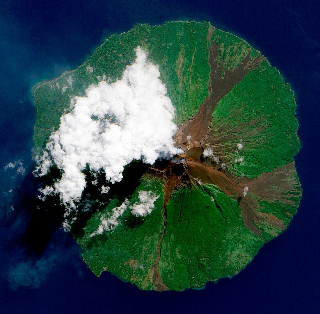
| Manam volcano,Papua New Guinea,taken on June 16,2010 by the Advanced Land Imager (ALI) on NASA's Earth Observing-1 (EO-1) satellite. Opaque white clouds partially obscure the satellite's view of Manam. The volcanic plume appears as a thin,blue-gray veil extending toward the northwest over the Bismarck Sea.Manam forms an island 10 kilometers (6 miles) wide and is located 13 kilometers (8 miles) off the coast of mainland Papua New Guinea. It is classified as a stratovolcano | |
| Licence : | Droits gérés |
| Crédit: | Science Photo Library / NASA |
| Taille de l’image : | 1952 px × 1917 px |
| Model Release : | Non requis |
| Property Release : | Non requis |
| Restrictions : | - |
Prix pour cette image À partir de 45 €
Produit vendu
(Calendrier, Carte postale, Carte de vœux, Impression sur textile, Packaging etc)
À partir de 45 €
Usage commercial
(Affichage, Annonce presse, Annonce TV, Carte, Digital - hors rés. sociaux, Digital - rés. sociaux etc)
À partir de 45 €
Éditorial
(Digital, Journal, Livre, Livre pratique, Magazine, Télévision etc)
À partir de 60 €
Usage non-commercial
(Digital - hors rés. sociaux, Digital - rés. sociaux etc)
À partir de 120 €