Shipping routes
Numéro d’image : 11613339
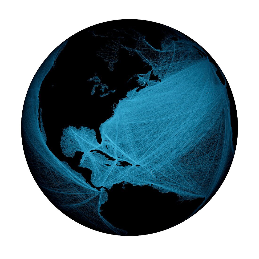
| Shipping routes around North and South America. Global map showing shipping routes superimposed over the Atlantic and Pacific Oceans. Data acquired from NOAA's SEAS BBXX database,from 14.10.2004 to 15.10.2005 | |
| Licence : | Droits gérés |
| Crédit: | Science Photo Library / Pharand-Deschenes, Felix |
| Taille de l’image : | 4488 px × 4488 px |
| Model Release : | Non requis |
| Property Release : | Non requis |
| Restrictions : | - |
Prix pour cette image À partir de 45 €
Produit vendu
(Calendrier, Carte postale, Carte de vœux, Impression sur textile, Packaging etc)
À partir de 45 €
Usage commercial
(Affichage, Annonce presse, Annonce TV, Carte, Digital - hors rés. sociaux, Digital - rés. sociaux etc)
À partir de 45 €
Éditorial
(Digital, Journal, Livre, Livre pratique, Magazine, Télévision etc)
À partir de 60 €
Usage non-commercial
(Digital - hors rés. sociaux, Digital - rés. sociaux etc)
À partir de 120 €
Mots clés
- 21ème siècle,
- américain,
- Amérique du Nord,
- Amérique du Sud,
- anthropocène,
- bateau,
- envoi,
- Etats-Unis,
- expédition,
- genre humain,
- géographie,
- géographique,
- humanité,
- illustration,
- image satellite,
- impact humain,
- itinéraire,
- moderne,
- modernité,
- monde de nuit,
- monde la nuit,
- observation de la terre,
- oeuvre,
- planète,
- présence humaine,
- route,
- routes,
- satellite,
- terre,
- transport,
- USA,
- voie,
- XX1ème siècle