Atmospheric pollutants,5 May 2003
Numéro d’image : 11610772
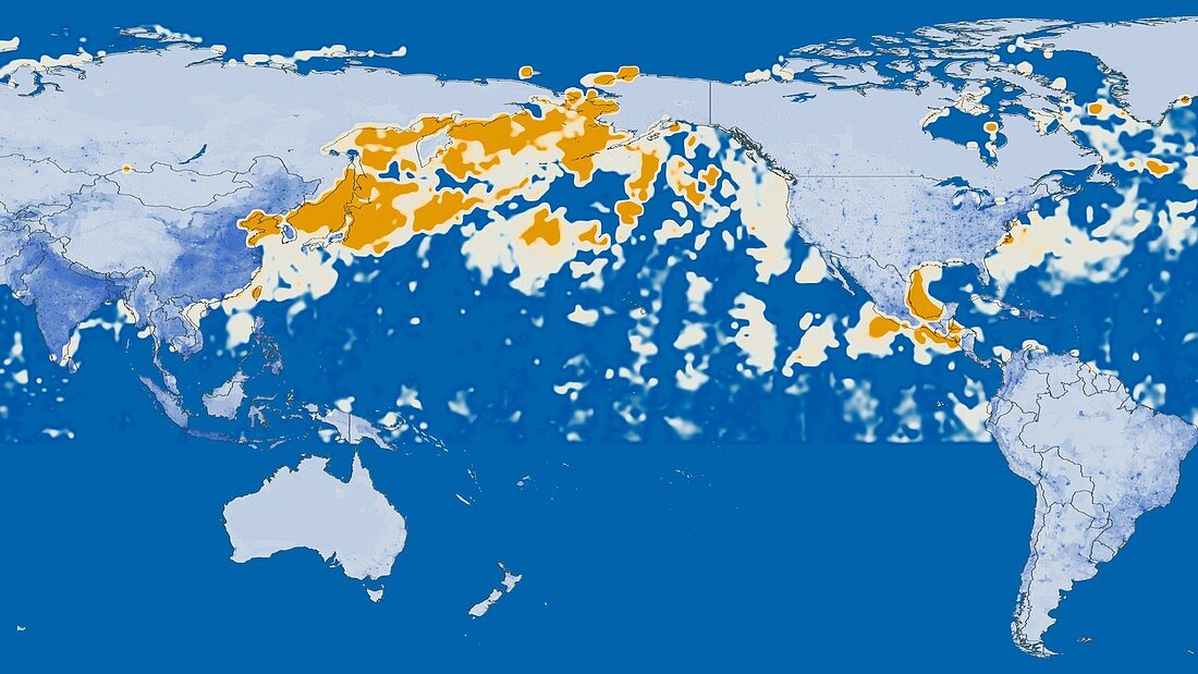
| Atmospheric pollutants. Map showing levels of anthropogenic aerosols in the Earth's atmosphere on 5th May 2003. Lower concentrations are beige,higher concentrations are orange. Much of this pollution is a result of the rapid industrialisation and growth of China and other parts of Asia. Although some is also due to coal-burning stoves and forest fires in Russia. The pollution is being blown from east Asia across the northern Pacific Ocean to the West coast of North America. Data obtained from the Moderate Resolution Imaging Spectroradiometer (MODIS) on board NASA's Terra satellite | |
| Licence : | Droits gérés |
| Crédit: | Science Photo Library / SVS / GSFC / NASA |
| Taille de l’image : | 3945 px × 2219 px |
| Model Release : | Non requis |
| Property Release : | Non requis |
| Restrictions : | - |
Prix pour cette image À partir de 45 €
Produit vendu
(Calendrier, Carte postale, Carte de vœux, Impression sur textile, Packaging etc)
À partir de 45 €
Usage commercial
(Affichage, Annonce presse, Annonce TV, Carte, Digital - hors rés. sociaux, Digital - rés. sociaux etc)
À partir de 45 €
Éditorial
(Digital, Journal, Livre, Livre pratique, Magazine, Télévision etc)
À partir de 60 €
Usage non-commercial
(Digital - hors rés. sociaux, Digital - rés. sociaux etc)
À partir de 120 €
Mots clés
- 21ème siècle,
- Asie,
- atmosphère,
- atmosphérique,
- Chine,
- feux de forêt,
- géographie,
- géographique,
- image satellite,
- incendies de forêt,
- industrialisation,
- industriel,
- mesure,
- modis,
- observation de la terre,
- Océan Pacifique,
- polluants,
- pollution,
- satellite,
- science atmosphérique,
- spectroradiomètre imageur à résolution moyenne,
- terra,
- terre,
- XX1ème siècle