Eyjafjallajokull volcano,satellite image
Numéro d’image : 11594152
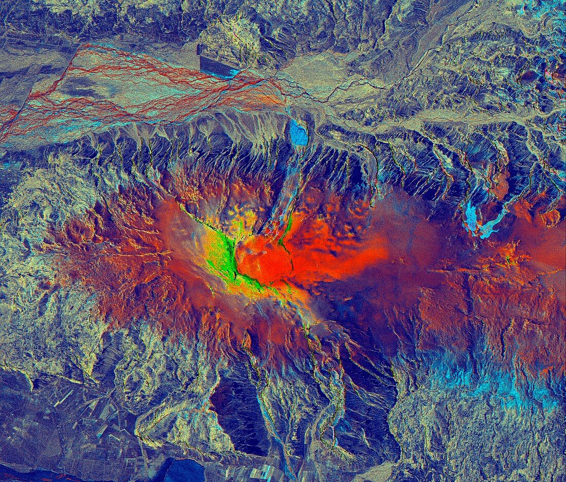
| Eyjafjallajokull volcano,Iceland,satellite radar image. North is at top. The ash from the volcanic eruptions under the Eyjafjallajokull glacier in March and April 2010 caused the closure of large parts of European airspace for several days. This composite image shows 25 March (red),16 April 2010 (green) and the difference (blue). The light blue area (right) was the site of the first eruption. The main eruption took place at centre (red,green and yellow). This area,around 26 kilometres across,was imaged by the TerraSAR-X,a European satellite that uses X-band (microwave) synthetic aperture radar (SAR) to observe the Earth from space | |
| Licence : | Droits gérés |
| Crédit: | Science Photo Library / Infoterra |
| Taille de l’image : | 3536 px × 3012 px |
| Model Release : | Non requis |
| Property Release : | Non requis |
| Restrictions : | - |
Prix pour cette image À partir de 45 €
Produit vendu
(Calendrier, Carte postale, Carte de vœux, Impression sur textile, Packaging etc)
À partir de 45 €
Usage commercial
(Affichage, Annonce presse, Annonce TV, Carte, Digital - hors rés. sociaux, Digital - rés. sociaux etc)
À partir de 45 €
Éditorial
(Digital, Journal, Livre, Livre pratique, Magazine, Télévision etc)
À partir de 60 €
Usage non-commercial
(Digital - hors rés. sociaux, Digital - rés. sociaux etc)
À partir de 120 €
Mots clés
- 2010,
- 21ème siècle,
- aléa,
- Atlantique,
- bande X,
- catastrophe naturelle,
- colonne de cendre,
- danger,
- de l'espace,
- éruption,
- Europe,
- européen,
- EYJAFJALLAJOKULL,
- fermeture,
- géographie,
- géographique,
- géologie,
- géologique,
- image satellite,
- islandais,
- Islande,
- montagne,
- observation de la terre,
- radar,
- radar à synthèse d'ouverture,
- rayon X,
- risque,
- satellite,
- science de la terre,
- volcan,
- volcanique,
- vulcanologie,
- XX1ème siècle