Al Kufrah oasis,satellite radar image
Numéro d’image : 11594150
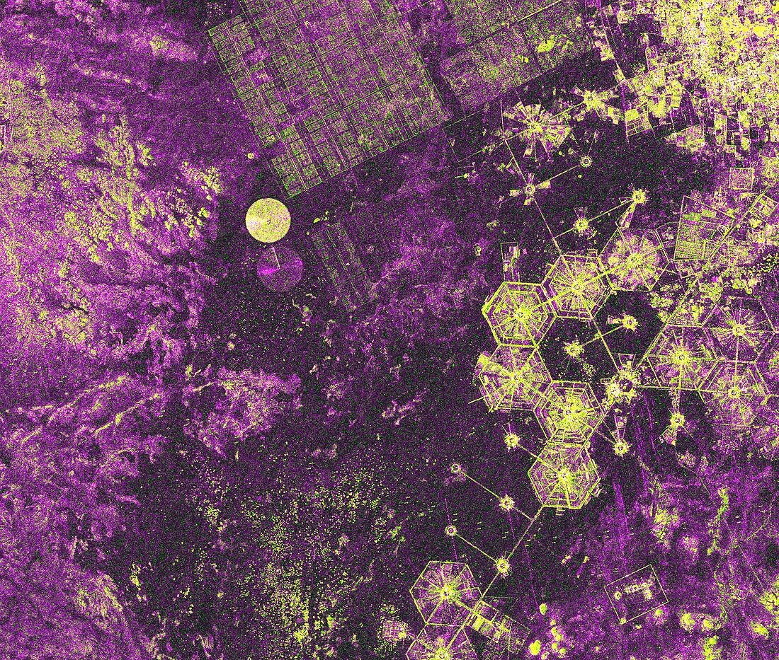
| Al Kufrah oasis,satellite radar image. North is at top. This oasis is in the desert of south-eastern Libya. The colours indicate different reflectivity of the radar. Artificial structures and bare rock (yellow) stand out from the sandy background (purple). Aquifers (hexagonal and circular,lower right) supply water for the settlement (buildings at top right) and the palm tree plantation (top centre). This image,showing an area around 14 kilometres across,was obtained by the TerraSAR-X satellite on 2 February 2009. This is a European satellite that uses X-band (microwave) synthetic aperture radar (SAR) to observe the Earth from space | |
| Licence : | Droits gérés |
| Crédit: | Science Photo Library / Infoterra |
| Taille de l’image : | 3599 px × 3053 px |
| Model Release : | Non requis |
| Property Release : | Non requis |
| Restrictions : | - |
Prix pour cette image À partir de 45 €
Produit vendu
(Calendrier, Carte postale, Carte de vœux, Impression sur textile, Packaging etc)
À partir de 45 €
Usage commercial
(Affichage, Annonce presse, Annonce TV, Carte, Digital - hors rés. sociaux, Digital - rés. sociaux etc)
À partir de 45 €
Éditorial
(Digital, Journal, Livre, Livre pratique, Magazine, Télévision etc)
À partir de 60 €
Usage non-commercial
(Digital - hors rés. sociaux, Digital - rés. sociaux etc)
À partir de 120 €
Mots clés
- 2009,
- 21ème siècle,
- africain,
- Afrique,
- agricole,
- agriculture,
- AL KUFRAH,
- Algerie,
- algérien,
- aquifère,
- bande X,
- couche aquifère,
- de l'espace,
- ferme,
- géographie,
- géographique,
- image satellite,
- industrie,
- industriel,
- ingénierie,
- nappe phréatique,
- oasis,
- observation de la terre,
- palmier,
- plantation,
- radar,
- radar à synthèse d'ouverture,
- rayon X,
- règlement,
- satellite,
- technologie,
- technologique,
- XX1ème siècle