Portuguese sea chart,16th century
Numéro d’image : 11592259
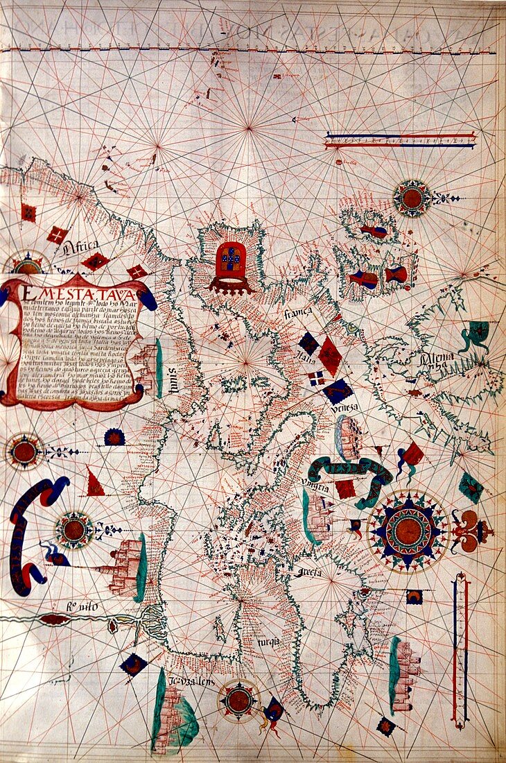
| Portuguese sea chart. 16th century nautical chart of the coastlines of Europe (right) and North Africa (left). North is at right. The chart shows the names of locations along the coastlines,and gives lines used for navigation at sea,but the interiors are left blank or used for flags and text. Nautical charts such as these were used during the Age of Discovery,that included the 1497-9 voyage of the Portuguese explorer Vasco da Gama,which opened the maritime trading route from Europe to India. This map is from a 1563 atlas by the Portuguese cartographer Lazaro Luis,at the Sciences Academy of Lisbon | |
| Licence : | Droits gérés |
| Crédit: | Science Photo Library / Landmann, Patrick |
| Taille de l’image : | 3411 px × 5138 px |
| Model Release : | Non requis |
| Property Release : | Non requis |
| Restrictions : | - |
Prix pour cette image À partir de 45 €
Produit vendu
(Calendrier, Carte postale, Carte de vœux, Impression sur textile, Packaging etc)
À partir de 45 €
Usage commercial
(Affichage, Annonce presse, Annonce TV, Carte, Digital - hors rés. sociaux, Digital - rés. sociaux etc)
À partir de 45 €
Éditorial
(Digital, Journal, Livre, Livre pratique, Magazine, Télévision etc)
À partir de 60 €
Usage non-commercial
(Digital - hors rés. sociaux, Digital - rés. sociaux etc)
À partir de 120 €
Mots clés
- 1500,
- 1563,
- 16ème siècle,
- africain,
- Afrique,
- âge de la découverte,
- carte,
- cartographie,
- cartographique,
- continent,
- côte,
- côtier,
- de navigation,
- diagramme,
- drapeau,
- drapeaux,
- Europe,
- européen,
- exploration,
- géographie,
- géographique,
- grandes découvertes,
- graphique,
- histoire,
- historique,
- illustration,
- Lisbonne,
- manuscrit,
- nautique,
- oeuvre,
- page,
- portugais,
- Portugal,
- région,
- tableau,
- XVIème siècle