San Francisco Bay,USA,satellite image
Numéro d’image : 11592219
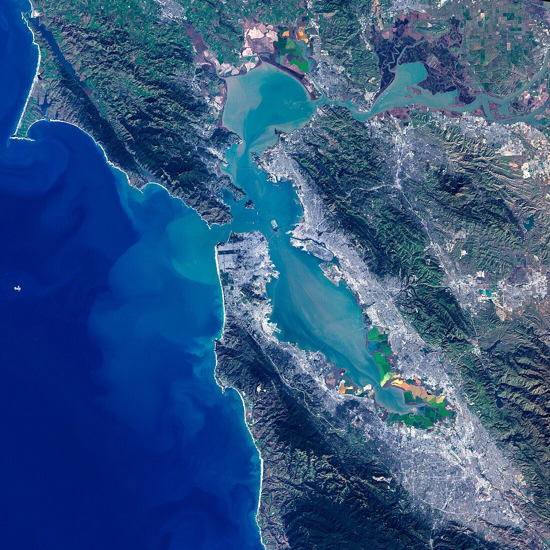
| San Francisco Bay,USA. Satellite image of the San Francisco Bay area in California,USA. North is at top. The city of San Francisco is located on the tip of the San Francisco Peninsula (southern peninsula at upper left). Salt pans (multicoloured) can be seen on the southerly edge of the bay. Forested areas are dark green,bare ground is brown,urban areas are grey,and water is black. Image taken by the Landsat 7 satellite | |
| Licence : | Droits gérés |
| Crédit: | Science Photo Library / NASA |
| Taille de l’image : | 4000 px × 4000 px |
| Model Release : | Non requis |
| Property Release : | Non requis |
| Restrictions : | - |
Prix pour cette image À partir de 45 €
Produit vendu
(Calendrier, Carte postale, Carte de vœux, Impression sur textile, Packaging etc)
À partir de 45 €
Usage commercial
(Affichage, Annonce presse, Annonce TV, Carte, Digital - hors rés. sociaux, Digital - rés. sociaux etc)
À partir de 45 €
Éditorial
(Digital, Journal, Livre, Livre pratique, Magazine, Télévision etc)
À partir de 60 €
Usage non-commercial
(Digital - hors rés. sociaux, Digital - rés. sociaux etc)
À partir de 120 €
Mots clés
- américain,
- Amérique du Nord,
- baie,
- bois,
- Californie,
- casseroles,
- côte,
- Côte Ouest,
- Côte Pacifique,
- côtier,
- croûte de sel,
- de l'espace,
- eau,
- Etats-Unis,
- forêt,
- forêts,
- géographie,
- géographique,
- image satellite,
- landsat 7,
- littoral,
- NASA,
- observation de la terre,
- océan,
- Océan Pacifique,
- région boisée,
- San Francisco,
- satellite,
- urbain,
- urbanisation,
- USA,
- végétation,
- ville